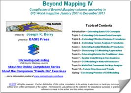
 Beyond Mapping Compilation Series
by
Joseph K. Berry
…Beyond Mapping
columns appearing
in GeoWorld (formally GIS World) magazine
from March 1989
through December 2013.
Most
(click for a hardcopy version of this document
posted at http://www.innovativegis.com/basis/BeyondMappingSeries/)
______________________________________________________________
Chronological
Listing
with hyperlinks to individual Beyond Mapping
columns
The following Chronological
Listing contains all of Beyond Mapping (BM) columns appearing in GeoWorld
from 1989 through 2013 organized by descending date into four
online/hardcopy books—
Beyond Mapping Book IV (2007 to
2013) — GIS
Modeling: Applying Map Analysis Tools and Techniques
Beyond Mapping Book III (1996
to 2007) — Map
Analysis: Understanding Spatial Patterns
and Relationships
Beyond Mapping Book II (1993 to
1996) — Spatial
Reasoning for Effective GIS
Beyond Mapping Book I (1989 to
1993) — Beyond
Mapping: Concepts, Algorithms and Issues
in GIS
|
|
|
|
|

______________________________________________________________
Navigation within this
tsunami of information is aided by four
additional organizational listings of the nearly 300 individual Beyond
Mapping columns (each column is
approximately 1200 words; 2½ pages)—
Application
Listing that
organizes the columns by application areas (.html and .pdf):
alphabetically sorted into the twenty-three major application groupings
Operations
Listing that
organizes the columns by topic/theme discussed (.html and .pdf); alphabetically sorted into ten General themes,
fifteen Analysis groupings and twelve Statistics groupings
Interactive
Listing that can be searched/sorted by word, phrase, topic, theme or
application area (.doc)
Combined
Index of
keywords and phrases covering all four books (.html and .pdf …in progress)
GIS Modeling:
Applying Map Analysis Tools and Techniques
|
Online Book |
Hardcopy
Book/CD |
|
Beyond
Mapping IV: A Compilation of Beyond Mapping Columns …is an online book
organizing the Beyond Mapping columns first published in GeoWorld (formally GIS World) from 2007 to 2013
into 10 Topics, Introduction and Epilog. |
GIS Modeling: Applying Map Analysis Tools and Techniques …is an electronic book (Basis
Press, 2013) of selected columns from 2007 to 2013 organized into 10
Topics, Introduction, Epilog, Index and a companion CD-ROM containing
Additional Readings, Color Graphics files, Instructor Materials and software
for hands-on exercises cross-referenced to the topics. |
< click> on the
hyperlinks below to access the columns compiled into the Beyond Mapping IV
online book
|
Date Code |
…Beyond Mapping columns below were published in the GIS
Modeling book/CD (February, 2007 to December
2013) |
GIS Modeling book Topic/Section |
||
|
2013.12 |
December |
2013 |
Where
Do We Go from Here? — Swan Song after 25 years of
Beyond Mapping columns |
Epilog, S2 |
|
2013.11 |
November |
2013 |
The
Good, the Bad and the Ugly Sides of GIS — discusses
the potential of geotechnology to hinder (or even thwart) societal progress |
Epilog, S1 |
|
2013.10 |
October |
2013 |
Laying
the Foundation for SpatialSTEM: Spatial Mathematics, Map Algebra and Map
Analysis — discusses the conceptual foundation and intellectual shifts
needed for SpatialSTEM |
Topic 9, S6 |
|
2013.09 |
September |
2013 |
The
Spatial Key to Seeing the Big Picture — describes a five step
process for generating grid map layers from spatially tagged data |
B4, Topic 9, Further Reading3 |
|
2013.08 |
August |
2013 |
Generating
Mountains and Molehills from Field Sampled Data — creating
an elevation surface from field sampled data |
B4, Topic 3, S4 |
|
2013.07 |
July |
2013 |
In
Search of the Elusive Image — describes extended geo-query
techniques for accessing images containing a location of interest |
B4, Topic 2, Further Reading3 |
|
2013.06 |
June |
2013 |
Setting
a Place at the Table for Grid-based Data — describes the differences
between individual file and table storage approaches |
B4, Topic 1, S4 |
|
2013.05 |
May |
2013 |
Mixing
It up in GIS Modeling’s Kitchen — an overview of map
analysis and GIS modeling considerations |
B4, Topic 5, S1 |
|
2013.04 |
April |
2013 |
Spatially
Evaluating the T-test — illustrates the expansion of traditional
math/stat procedures to operate on map variables to spatially solve
traditional non-spatial equations |
B4, Topic 4, S5 |
|
2013.03 |
March |
2013 |
Depending
on Where is What — develops an organizational structure for spatial
statistics |
B4, Topic 9, S5 |
|
2013.02 |
February |
2013 |
Recasting
Map Analysis Operations for General Consumption — reorganizes
ArcGIS’s Spatial Analyst tools into the SpatialSTEM framework that extends
traditional math/stat procedures |
B4, Topic 9, Further Reading4 |
|
2013.01 |
January |
2013 |
Optimal
Path Density is not all that Dense (Conceptually) — uses Optimal Path
Density Analysis to identify “corridors of common access” |
B4, Topic 8, Further Reading3 |
|
2012.12 |
December |
2012 |
Bringing
Travel and Terrain Directions into Line — describes comparison procedures and route evaluation techniques |
B4, Topic 8, Further Reading2 |
|
2012..11 |
November |
2012 |
Just
How Crooked Are Things? — discusses distance-related metrics
for assessing crookedness |
B4, Topic 2, Further Reading1 |
|
2012.10 |
October |
2012 |
To
Boldly Go Where No Map Has Gone Before — identifies Lat/Lon as a
Universal Spatial Key for joining database tables |
B4, Topic 9, S4 |
|
2012.09 |
September |
2012 |
Organizing
Geographic Space for Effective Analysis — an overview of data
organization for grid-based map analysis |
B4, Topic 1, S1 |
|
2012.08 |
August |
2012 |
Altering
Our Spatial Perspective through Dynamic Windows — discusses the three types
of roving windows— fixed, weighted and dynamic |
B4, Topic 3, S5 |
|
2012.07 |
July |
2012 |
Narrowing-In
on Absurd Gerrymanders — discusses how a Narrowness Index (NI) can be
applied to assess redistricting configurations |
B4, Topic 2, S5 |
|
2012.06 |
June |
2012 |
Questioning
GIS in Higher Education — describes thoughts and notes from a panel
discussion on “GIS in Higher Education” |
B4, Topic 6, Further Reading |
|
2012.05 |
May |
2012 |
Infusing
Spatial Character into Statistics — describes a statistical structure for
spatial statistics operations |
B4, Topic 9, S3 |
|
2012.04 |
April |
2012 |
Simultaneously
Trivializing and Complicating GIS — describes a mathematical structure
for spatial analysis operations |
B4, Topic 9, S2 |
|
2012.03 |
March |
2012 |
Paint
by Numbers Outside the Traditional Statistics Box —
discusses the nature of Spatial Statistics operations |
B4, Topic 9, Further Reading2 |
|
2012.02 |
February |
2012 |
Map-ematically
Messing with Mapped Data — discusses the nature of
grid-based mapped data and Spatial Analysis operations |
B4, Topic 9, Further Reading1 |
|
2012.01 |
January |
2012 |
SpatialSTEM
Has Deep Mathematical Roots — provides a conceptual
framework for a map-ematical treatment of mapped
data |
B4, Topic 9, S1 |
|
2011.12 |
December |
2011 |
VtoR and Back! — describes various techniques
for converting between vector and raster data types |
B4, Topic 1, S3 |
|
2011.11 |
November |
2011 |
Contour
Lines versus Color Gradients for Displaying Spatial Information — discusses
the similarities and differences between discrete contour line and continuous
gradient procedures for visualizing map surfaces |
B4, Topic 1, S4 |
|
2011.10 |
October |
2011 |
The
Universal Key for Unlocking GIS’s Full Potential — outlines a
global referencing system approach compatible with standard DBMS systems |
B4, Topic 7, S6 |
|
2011.09 |
September |
2011 |
Assessing
Wildfire Response (Part 2): Jumping
Right into It — describes
map analysis procedures for determining initial response time for alternative
attack modes |
B4, Topic 8, Further Reading5 |
|
2011.08 |
August |
2011 |
Assessing
Wildfire Response (Part 1): Oneth by Land, Twoeth by
Air — discusses a spatial model for
determining effective helicopter landing zones |
B4, Topic 8, Further Reading4 |
|
2011.07 |
July |
2011 |
Extending
Information into No-Data Areas — describes a technique for
“filling-in” information from surrounding data into no-data locations |
B4, Topic 2, Further Reading1 |
|
2011.06 |
June |
2011 |
Breaking
Away from Breakpoints — describes the use of curve-fitting
to derive continuous equations for suitability model ratings |
B4, Topic 4, Further Reading3 |
|
2011.05 |
May |
2011 |
Correlating
Maps and a Numerical Mindset — describes a Spatially Localized
Correlation procedure for mapping the mutual relationship between two map
variables |
B4, Topic 4, S4 |
|
2011.04 |
April |
2011 |
Comparing
Apples and Oranges — describes a Standard Normal Variable
(SNV) procedure for normalizing maps for comparison |
B4, Topic 4, Further Reading2 |
|
2011.03 |
March |
2011 |
A
Dynamic Tune-up for Distance Calculations — describes the algorithms
for dynamic effective distance procedures involving intervening conditions |
B4, Topic 2, S2 |
|
2011.02 |
February |
2011 |
Advancing
the Concept of Effective Distance — describes the
algorithms used in implementing Starter value advanced techniques |
B4, Topic 2, S1 |
|
2011.01 |
January |
2011 |
Which
Direction Are You Headed? — describes
four perspectives on the trailing “S” in the GIS acronym from a GIS’ers
Perspective |
B4, Topic 6, S1 |
|
2010.12 |
December |
2010 |
GIS’s
Supporting Role in the Future of Natural Resources — discusses the influence of human
dimensions in natural resources and GIS technology’s role |
B4, Topic 8, S6 |
|
2010.11 |
November |
2010 |
A
Suitable Framework for GIS Modeling — describes a framework for suitability modeling based on a
flowchart of model logic |
B4, Topic 5, S5 |
|
2010.10 |
October |
2010 |
Putting
GIS Modeling Concepts in Their Place — develops a typology of GIS modeling types and
characteristics |
B4, Topic 5, S4 |
|
2010.09 |
September |
2010 |
Comparing
Emergency Response Alternatives — describes comparison procedures and route evaluation
techniques |
B4, Topic 8, S5 |
|
2010.08 |
August |
2010 |
Extending
Emergency Response Beyond the Lines — discusses basic model processing and modifications for
additional considerations |
B4, Topic 8, S4 |
|
2010.07 |
July |
2010 |
E911
for the Backcountry — describes
development of an on- and off-road travel-time surface for emergency response |
B4, Topic 8, S3 |
|
2010.06 |
June |
2010 |
A
Twelve-step Program for Recovery
from Flaky Forest Formulations — describes a spatial model for identifying Landings and
Timbersheds |
B4, Topic 8, Further Reading1 |
|
2010.05 |
May |
2010 |
Extending
Forest Harvesting’s Reach — discusses a multiplicative
weighting method for model extension |
B4, Topic 8, S2 |
|
2010.04 |
April |
2010 |
Harvesting
an Understanding of GIS Modeling — describes a prototype
model for assessing off-road access to forest areas |
B4, Topic 8, S1 |
|
2010.03 |
March |
2010 |
Fitting
Square Pegs into Round GIS Educational Holes — discusses the need
to engage non-GIS students in developing spatially distributed solutions |
B4, Topic 6, S4 |
|
2010.02 |
February |
2010 |
GIS
Education’s Need for “Hitchhikers” — establishes the need for
engaging “domain experts” in moving geotechnology to the next level |
B4, Topic 6, S3 |
|
2010.01 |
January |
2010 |
A
Quick Peek Outside GIS’s Disciplinary Cave — discusses
future directions of geotechnology with particular emphasis on career outlook
and GIS education |
B4, Topic 6, S2 |
|
2009.12 |
December |
2009 |
From
a Map Pancake to a Soufflé — continues the discussion of concepts
and configuration of a 3D GIS |
B4, Topic
10, Further Reading1 |
|
2009.11 |
November |
2009 |
Thinking
Outside the Box — discusses concepts and configuration of
3-dimensional geography |
B4, Topic
10, S4 |
|
2009.10 |
October |
2009 |
Visualizing
a Three-dimensional Reality — uses visual connectivity to
introduce and reinforce the paradigm of three-dimension geography |
B4, Topic
10, S3 |
|
2009.09 |
September |
2009 |
GIS
and the Cloud Computing Conundrum
— describes cloud computing with particular attention to its
geotechnology expression |
B4, Topic
10, S2 |
|
2009.08 |
August |
2009 |
Use
Spatial Sensitivity Analysis to Assess Model Response — develops an approach for assessing the sensitivity of GIS
models |
B4, Topic 5, Further Reading2 |
|
2009.07 |
July |
2009 |
Melding
the Minds of the “-ists” and “-ologists”
— elaborates on the two basic mindsets
driving the geotechnology community |
B4, Topic 6, Further Reading2 |
|
2009.06 |
June |
2009 |
A
Narrow-minded Approach — describes how Narrowness maps are
derived |
B4, Topic
2, S4 |
|
2009.05 |
May |
2009 |
Identifying
Upland Ridges — describes a procedure for locating
extended upland ridges |
B4, Topic
3, S3 |
|
2009.04 |
April |
2009 |
What’s
Missing in Mapping? — discusses the need for identifying
data dispersion as well as average in Thematic Mapping |
B4, Topic 4, S1 |
|
2009.03 |
March |
2009 |
What’s
in a Name — suggests and defines the new more
comprehensive term “Geotechnology” |
B4, Intro, Further Reading2 |
|
2009.02 |
February |
2009 |
Is
it Soup Yet? — describes the evolution in GIS
definitions and terminology |
B4, Intro, Further Reading1 |
|
2009.01 |
January |
2009 |
Follow
These Steps to Map Potential Sales — describes an
extensive geo-business application that combines retail competition analysis
and product sales prediction |
B4, Topic 7, Further Reading4 |
|
2008.12 |
December |
2008 |
Can
We Really Map the Future? — describes the use of
“linear regression” to develop prediction equations relating dependent and
independent map variables |
B4, Topic 7, Further Reading3 |
|
2008.11 |
November |
2008 |
Discover
the “Miracles” in Mapping Data Clusters — describes
the use of “clustering” to identify inherent groupings of similar data
patterns |
B4, Topic 7, S5 |
|
2008.10 |
October |
2008 |
Get
“Map-ematical” to Identify Data Zones
— describes the use of “level-slicing” for classifying locations with a
specified data pattern |
B4, Topic 7, Further Reading2 |
|
2008.09 |
September |
2008 |
Use
Map Analysis to Characterize Data Groups — describes the use of
“data distance” to derive similarity among the data patterns in a set of map
layers |
B4, Topic 7, S4 |
|
2008.08 |
August |
2008 |
Interpreting
Interpolation Results (and why it is important) — describes the
use of “residual analysis” for evaluating spatial interpolation performance |
B4, Topic 7, Further Reading1 |
|
2008.07 |
July |
2008 |
Myriad
Techniques Help to Interpolate Spatial Distributions — discusses
the basic concepts underlying spatial interpolation |
B4, Topic 7, S3 |
|
2008.06 |
June |
2008 |
Linking
Numeric and Geographic Distributions — investigates the link
between numeric and geographic distributions of mapped data |
B4, Topic 7, S2 |
|
2008.05 |
May |
2008 |
Shedding
Light on Terrain Analysis — discusses how terrain orientation is
used to generate Hillshade maps |
B4, Topic
3, Further Reading1 |
|
2008.04 |
April |
2008 |
Twisting
the Perspective of Map Surfaces — describes the character of spatial
distributions through the generation of a customer density surface |
B4, Topic 7, S1 |
|
2008.03 |
March |
2008 |
Contiguity
Ties Things Together — describes an analytical approach for
determining effective contiguity (clumped features) |
B4, Topic 2, S3 |
|
2008.02 |
February |
2008 |
How
to Determine Exactly “Where Is What” — discusses the levels of precision (correct placement)
and accuracy (correct characterization) |
B4, Topic 5, S2 |
|
2008.01 |
January |
2008 |
Explore
the Softer Side of GIS — describes a Manual GIS
(circa 1950) and the relationship between social science conceptual
frameworks for understanding/judgment in GIS modeling |
B4, Topic 5, Further Reading1 |
|
2007.12 |
December |
2007 |
Lumpers
and Splitters Propel GIS — describes the two camps
of GIS (GeoExploration and GeoScience)
|
B4, Topic 6, Further Reading1 |
|
2007.11 |
November |
2007 |
Throwing
the Baby Out with the Bath Water — discusses the information
lost in aggregating field data and assigning typical values to polygons
(desktop mapping) |
B4, Topic
4, S2 |
|
2007.10 |
October |
2007 |
Get
a Consistent Statistical Picture — describes creation of a
Standardized Map Variable surface using Median and Quartile Range |
B4, Topic
4, Further Reading1 |
|
2007.09 |
September |
2007 |
Normally
Things Aren’t Normal — discusses the appropriateness of using
traditional “normal” and percentile statistics |
B4, Topic
4, S3 |
|
2007.08 |
August |
2007 |
GIS
Innovation Drives Its Evolution — discusses the cyclic nature of
GIS innovation (Mapping, Structure and Analysis) |
B4, Topic 10, S1 |
|
2007.07 |
July |
2007 |
The
Long and Short of Slope — investigates
longitudinal and transverse slope calculation |
B4, Topic
3, S2 |
|
2007.06 |
June |
2007 |
Segmenting
Our World — discusses
techniques for segmenting linear routes based on terrain inflection |
B4, Topic
3, S1 |
|
2007.05 |
May |
2007 |
Getting
the Numbers Right — describes a classification scheme for map analysis operations based on
how map values are retrieved for processing (Local, Focal, Zonal) |
B4, Topic
5, S3 |
|
2007.04 |
April |
2007 |
Geo-Referencing
Is the Cornerstone of GIS — describes current and alternative
approaches for referencing geographic and abstract space |
B4, Intro,S3 |
|
2007.03 |
March |
2007 |
Understand
Resolution to “Think with Maps” — discusses the factors that determine
the “informational scale” digital maps |
B4, Intro, S2 |
|
2007.02 |
February |
2007 |
Finding
Common Ground in Paper and Digital Worlds — describes
the similarities and differences in information and organization between
traditional paper and digital maps |
B4, Intro, S1 |
_____________________________________________________________________________________
Return to Top of the listing
Permission to use portions of the Beyond
Mapping Compilation Series collection of columns for educational
and non-commercial
purposes is granted provided reference is made to the author and the URL
of the Beyond Mapping
Compilation Series Topic of the online book containing the materials—
For example… Figure is from Berry, Beyond Mapping
Compilation Series, Book I, Topic 4 “What GIS Is and Isn’t”
posted
at: www.innovativegis.com/Basis/BeyondMappingSeries/
Map Analysis: Understanding Spatial Patterns and
Relationships
|
Online Book |
Hardcopy Book/CD |
|
Beyond
Mapping III: A Compilation of Beyond Mapping Columns …is an online book organizing
the Beyond Mapping columns first published in GIS World/GeoWorld from 1996 to
2007 into 10 Topics, Introduction, Epilog and Further Readings. |
Map
Analysis: Understanding
Spatial Patterns and Relationships …is a hardcopy book (GeoTec
Media, 2007) of selected columns from 1996 to 2007 organized into 10
Topics, Introduction, Epilog, Index and a companion CD-ROM containing
Additional Readings, Color Graphics files, Instructor Materials and software
for hands-on exercises cross-referenced to the topics. |


Note: click on the hyperlinks below to access the columns
compiled into the Beyond Mapping III online book.
|
Date Code |
…BM columns below
were published in the Map Analysis book/CD (September 1996
to January, 2007). |
Map Analysis book Topic/Section |
||
|
2007.01 |
January |
2007 |
A
Multifaceted GIS Community — investigates the technical shifts
and cultural impacts of the rapidly expanding GIS tent of users, application
developers and tool programmers |
B3, Epilog, S2 |
|
2006.12 |
December |
2006 |
Pathways
to GIS — explores different paths of GIS adoption for five
disciplines (Natural Resources, Facilities Management, Public Health,
Business and Precision Agriculture) |
B3, Epilog, S1 |
|
2006.11 |
November |
2006 |
Contemporary
GIS and Future Directions — discusses contemporary GIS and
probable future directions (Multimedia Mapping and Spatial Reasoning/Dialog) |
B3, Intro, S2 |
|
2006.10 |
October |
2006 |
Early
GIS Technology and Its Expression — traces the early phases of
GIS technology (Computer Mapping, Spatial Database Management and Map
Analysis/Modeling) |
B3, Intro, S1 |
|
2006.09 |
September |
2006 |
Statistically
Compare Continuous Map Surfaces — discusses procedures for comparing
continuous map surfaces |
B3, Topic 10, S2 |
|
2006.08 |
August |
2006 |
Spatial
Data Mining “Down on the Farm” — discusses
process for moving from Whole-Field
to Site-Specific management |
B3, Topic 10, S6 |
|
2006.07 |
July |
2006 |
Statistically
Compare Discrete Maps — discusses procedures for comparing
discrete maps |
B3, Topic 10, S1 |
|
2006.06 |
June |
2006 |
Under
the Hood of Spatial Interpolation — investigates
the basic concepts in IDW and Kriging interpolation procedures |
B3, Topic
9, S3 |
|
2006.05 |
May |
2006 |
The
Average Is Hardly Anywhere — discusses the difference between
spatial and non-spatial data distributions |
B3, Topic
9, S2 |
|
2006.04 |
April |
2006 |
Key
Concepts Characterize Unique Conditions — describes a technique for handling
unique combinations of map layers |
B3, Topic 3, Further Reading1 |
|
2006.03 |
March |
2006 |
Use
LCP Procedures to Center Optimal Paths — discusses a procedure for
eliminating “zig-zags” in areas of minimal siting
preference |
B3, Topic 8, Further Reading2 |
|
2006.02 |
February |
2006 |
Nearby
Things Are More Alike — use of decay functions in
weight-averaging surrounding conditions |
B3, Topic 6, Further Reading2 |
|
2006.01 |
January |
2006 |
Spatially
Aggregated Reporting: The Probability is Good — discusses
techniques for smoothing “salt and pepper” results and deriving probability
surfaces from aggregated incident records |
B3, Topic 6, S3 |
|
2005.12 |
December |
2005 |
Filtering
for the Good Stuff — investigates a couple of spatial filters for
assessing neighborhood connectivity and variability |
B3, Topic 6 , Further Reading3 |
|
2005.11 |
November |
2005 |
Milking
Spatial Context Information — describes a procedure for deriving
a customer density surface |
B3, Topic 6, S2 |
|
2005.10 |
October |
2005 |
Computer
Processing Aids Spatial Neighborhood Analysis — discusses
approaches for calculating slope and profile |
B3, Topic 6, S1 |
|
2005.09 |
September |
2005 |
Connect
All the Dots to Find Optimal Paths — describes a procedure for
determining an optimal path network from a dispersed set of end points |
B3, Topic 8, Further Reading3 |
|
2005.08 |
August |
2005 |
Taking
Distance to the Edge — discusses advance distance operations |
B3, Topic 4, Further Reading3 |
|
2005.07 |
July |
2005 |
Calculate
and Compare to Find Effective Proximity — describes how effective
proximity is calculated |
B3, Topic 4, Further Reading2 |
|
2005.06 |
June |
2005 |
Extend
Simple Proximity to Effective Movement — discusses
the concept of effective distance responding to relative and absolute
barriers |
B3, Topic 4, S4 |
|
2005.05 |
May |
2005 |
Use
Cells and Rings to Calculate Simple Proximity — describes how
simple proximity is calculated |
B3, Topic 4, Further Reading1 |
|
2005.04 |
April |
2005 |
Measuring
Distance Is Neither Here nor There — discusses the basic concepts
of distance and proximity |
B3, Topic 4, S3 |
|
2005.03 |
March |
2005 |
Making
Space for Mapped Data — investigates the link between geographic space
and data space for mapping data patterns |
B3, Topic 2, S4 |
|
2005.02 |
February |
2005 |
Use
Spatial Statistics to Map Abnormal Averages — discusses surface
modeling to characterize the spatial distribution inherent in a data set |
B3, Topic 2, S3 |
|
2005.01 |
January |
2005 |
Bending
Our Understanding of Distance — uses effective distance in
establishing erosion setback to demonstrate spatial analysis |
B3, Topic 2, S2 |
|
2004.12 |
December |
2004 |
Moving
Mapping to Analysis of Mapped Data — describes Spatial Analysis and
Spatial Statistics as extensions to traditional mapping and statistics |
B3, Topic 2, S1 |
|
2004.11 |
November |
2004 |
’Straightening’
Conversions Improve Optimal Paths — discusses a procedure for spatially
responsive straightening of optimal paths |
B3, Topic 8, Further Reading1 |
|
2004.10 |
October |
2004 |
Logic
and Extent Elevate Suitability Models to New Levels — extends
Rating discussion to include additional habitat considerations and model
weighting |
B3, Topic 7, S3 |
|
2004.09 |
September |
2004 |
Use
“Shadow Maps” to Understand Overlay Errors — describes
how shadow maps of certainty can be used to estimate error and its
propagation |
B3, Topic 3, Further Reading2 |
|
2004.08 |
August |
2004 |
Mapping
Techniques Rate Hugag Habitat Suitability — expands
discussion to Binary Progression and Rating suitability models |
B3, Topic 7, S2 |
|
2004.07 |
July |
2004 |
Suitability
Models Find the Good, the Bad and the Hugag — describes a simple suitability
model for characterizing habitat |
B3, Topic 7, S1 |
|
2004.06 |
June |
2004 |
Computers
Quickly Characterize Spatial Coincidence — discusses
several human considerations in implementing |
B3, Topic 3, S4 |
|
2004.05 |
May |
2004 |
Overlay
Operations Feature a Variety of Options — discusses
the basic overlaying map operations |
B3, Topic 3, S3 |
|
2004.04 |
April |
2004 |
Options
Seem Endless When Reclassifying Maps — discusses the basic reclassifying
map operations |
B3, Topic 3, S2 |
|
2004.03 |
March |
2004 |
Use
a Map-ematical Framework for GIS Modeling — describes
a conceptual structure for map analysis operations and GIS modeling |
B3, Topic
3, S1 |
|
2004.02 |
February |
2004 |
Migration
Modeling Determines Spill Effect — describes procedures for assessing
overland and channel flow impacts |
B3, Topic 4, Further Reading21 |
|
2004.01 |
January |
2004 |
Use
Available Tools to Calculate Flow Time and Quantity — discusses
procedures for tracking flow time and quantity |
B3, Topic 4, Further Reading20 |
|
2003.12 |
December |
2003 |
Constructing
Realistic Downhill Flows Proves Difficult — discusses
procedures for characterizing path, sheet, horizontal and fill flows |
B3, Topic 4, Further Reading19 |
|
2003.11 |
November |
2003 |
Traditional
Approaches Can’t Characterize Overland Flow — describes
the basic considerations in overland flow |
B3, Topic 4, Further Reading18 |
|
2003.10 |
October |
2003 |
Think
with Maps to Evaluate Alternative Routes — describes
procedures for comparing routes |
B3, Topic 8, S4 |
|
2003.09 |
September |
2003 |
A
Recipe for Calibrating and Weighting GIS Model Criteria — identifies
procedures for calibrating and weighting map layers in GIS models |
B3, Topic 8, S3 |
|
2003.08 |
August |
2003 |
Consider
Multi-Criteria When Routing — discusses
the construction of a discrete “cost/avoidance” map and optimal path
corridors |
B3, Topic 8, S2 |
|
2003.07 |
July |
2003 |
A
Three-Step Process Identifies Preferred Routes — describes
the basic steps in Least Cost Path analysis |
B3, Topic 8, S1 |
|
2003.06 |
June |
2003 |
Use
Mapping “Art” to Visualize Values — describes procedures for generating
contour maps |
B3, Topic 1, Further Reading2 |
|
2003.05 |
May |
2003 |
Turning
GIS Education on Its Head — describes the numerous GIS career
pathways and the need to engage prospective students from a variety of fields |
B3, Epilog,
Further Reading6 |
|
2003.04 |
April |
2003 |
Multiple
Methods Help Organize Raster Data — discusses different approaches to
storing raster data |
B3, Topic 1, Further Reading1 |
|
2003.03 |
March |
2003 |
Try
Vulnerability Maps to Visualize Aesthetics — describes
a procedure for deriving an aesthetics map based on visual exposure to pretty
and ugly places |
B3, Topic
5, Further Reading2 |
|
2003.02 |
February |
2003 |
Use
Maps to Assess Visual Vulnerability — discusses a procedure for
identifying visually vulnerable areas |
B3, Topic
5, Further Reading1 |
|
2003.01 |
January |
2003 |
Beware
of Slope’s Slippery Slope — describes various slope calculations
and compares results |
B3, Topic
6, Further Reading7 |
|
2002.12 |
December |
2002 |
Use
Surface Area for Realistic Calculations — describes
a technique for adjusting planimetric area to surface area considering
terrain slope |
B3, Topic
6, Further Reading8 |
|
2002.11 |
November |
2002 |
Identify
Valley Bottoms in Mountainous Terrain — illustrates
a technique for identifying flat areas connected to streams |
B3, Topic
4, Further Reading17 |
|
2002.10 |
October |
2002 |
Accumulation
Surfaces Connect Bus Riders and Stops — discusses an accumulation surface
analysis procedure for linking riders with bus stops |
B3, Topic 4, Further Reading8 |
|
2002.09 |
September |
2002 |
Normalizing
Maps for Data Analysis — describes map normalization and data
exchange with other software packages |
B3, Topic 1, S3 |
|
2002.08 |
August |
2002 |
Maps
Are Numbers First, Pictures Later — discusses the numeric and geographic
characteristics of map values |
B3, Topic
1, S2 |
|
2002.07 |
July |
2002 |
Grids
and Lattices Build Visualizations — describes Lattice and Grid forms of
map surface display |
B3, Topic 1, S1 |
|
2002.06 |
June |
2002 |
Use
Travel Time to Connect with Customers — describes techniques for optimal
path and catchment analysis |
B3, Topic 4, Further Reading11 |
|
2002.05 |
May |
2002 |
Grid-Based
Mapping Identifies Customer Pockets and Territories — identifies techniques for
identifying unusually high customer density and for delineating spatially
balanced customer territories |
B3, Topic 6, Further Reading1 |
|
2002.04 |
April |
2002 |
Maps
and Curves Can Spatially Characterize Customer Loyalty — describes a technique for
characterizing customer sensitivity to travel-time |
B3, Topic 4, Further Reading10 |
|
2002.03 |
March |
2002 |
Use Travel Time to Identify Competition
Zones — discusses the procedure for deriving
relative travel-time advantage maps |
B3, Topic 4, Further Reading9 |
|
2002.02 |
February |
2002 |
Stratify
Maps to Make Better Predictions — illustrates
a procedure for subdividing an area into smaller more homogenous groups prior
to generating prediction equations |
B3, Topic 10, Further Reading10 |
|
2002.01 |
January |
2002 |
Spatial
Data Mining Allows Users to Predict Maps — describes the basic concepts and
procedures for deriving equations that can be used to derive prediction maps |
B3, Topic 10, Further Reading9 |
|
2001.12 |
December |
2001 |
Use
Statistics to Map Data Clusters — discusses
clustering for partitioning an area into separate data groups |
B3, Topic 10, S5 |
|
2001.11 |
November |
2001 |
Use
Similarity to Identify Data Zones — describes
level-slicing for classifying areas into zones containing a specified data
pattern |
B3, Topic 10, S4 |
|
2001.10 |
October |
2001 |
Geographic
Software Removes Guesswork from Map Similarity — discusses
basic considerations and procedures for generating similarity maps |
B3, Topic 10, S3 |
|
2001.09 |
September |
2001 |
Use
Polar Variograms to Assess Distance and Direction Dependencies — discuses a
procedure to incorporate direction as well as distance for assessing spatial
dependency |
B3, Topic 9, Further Reading10 |
|
2001.08 |
August |
2001 |
Use
Exposure Maps and Fat Buttons to Assess Visual Impact — investigates
procedures for assessing visual exposure |
B3, Topic
5, S4 |
|
2001.07 |
July |
2001 |
Visual
Exposure is in the Eye of the Beholder — describes procedures for assessing
visual impact and creating simple models |
B3, Topic
5, S3 |
|
2001.06 |
June |
2001 |
Identify
and Use Visual Exposure to Create Viewshed Maps — discusses
basic considerations and procedures for establishing visual connectivity |
B3, Topic
5, S2 |
|
2001.05 |
May |
2001 |
Consider
Slope and Scenic Beauty in Deriving Hiking Maps — describes a general procedure for
weighting friction maps to reflect different objectives |
B3, Topic 4, Further Reading7 |
|
2001.04 |
April |
2001 |
Derive
and Use Hiking-Time Maps for Off-Road Travel — discusses procedures for
establishing hiking-time buffers responding to off-road travel |
B3, Topic 4, Further Reading6 |
|
2001.03 |
March |
2001 |
Integrate
Travel-Time into Mapping Packages — describes procedures for
transferring travel-time data to other maps |
B3, Topic 4, Further Reading5 |
|
2001.02 |
February |
2001 |
Use
Travel-Time Buffers to Map Effective Proximity — discusses
procedures for establishing travel-time buffers responding to street type |
B3, Topic 4, Further Reading4 |
|
2001.01 |
January |
2001 |
Create
Effective Distance Buffers to Improve Map Accuracy — develops
procedures for creating buffers that respond to the relative ease of
movement |
B3, Topic 4, S2 |
|
2000.12 |
December |
2000 |
Line-of-Sight
Buffers Add Intelligent to Maps — describes
procedures for creating buffers that track relative visual exposure and noise
levels |
B3, Topic 5, S1 |
|
2000.11 |
November |
2000 |
Extending
GIS Procedures with Variable-Width Buffers — discusses
the basic considerations in establishing variable-width buffers that respond
to both intervening conditions and the type of connectivity |
B3, Topic 4, S1 |
|
2000.10 |
October |
2000 |
Video
Mapping Brings Maps to Life — describes how video
maps are generated and discusses some applications of video mapping |
B3, Intro, Further Reading9 |
|
2000.09 |
September |
2000 |
Capture
"Where and When" on Video-based GIS — describes
how |
B3, Intro, Further Reading8 |
|
2000.08 |
August |
2000 |
How
to Represent Changes in a Virtual Forest — discusses
how simulations and "fly-bys" are used to visualize landscape
changes and characteristics |
B3, Intro, Further Reading7 |
|
2000.07 |
July |
2000 |
How
to Rapidly Construct a Virtual Scene — describes
the procedures in generating a virtual scene from landscape inventory
data |
B3, Intro, Further Reading6 |
|
2000.06 |
June |
2000 |
Behind
the Scenes of Virtual Reality — discusses the basic
considerations and concepts in 3D-object rendering |
B3, Intro, Further Reading5 |
|
2000.05 |
May |
2000 |
Modeling Erosion and Sediment Loading
— illustrates a |
B3, Topic 4, Further Reading16 |
|
2000.04 |
April |
2000 |
Confluence
Maps Further Characterize Micro-terrain Features — describes
the use of optimal path density analysis for mapping surface flows |
B3, Topic 4, Further Reading15 |
|
2000.03 |
March |
2000 |
Characterizing Terrain Slope and Roughness
— discusses techniques for determining terrain inclination and
coarseness |
B3, Topic 6, Further Reading6 |
|
2000.02 |
February |
2000 |
Characterizing Local Terrain Conditions
— discusses the use of "roving windows" to distinguish
localized variations |
B3, Topic 6, Further Reading5 |
|
2000.01 |
January |
2000 |
Use
Data to Characterize Micro-Terrain Features — describes
techniques to identify convex and concave features |
B3, Topic 6, Further Reading4 |
|
1999.12 |
December |
1999 |
Can
Predictable Maps Work for You? — describes a procedure for deriving a
spatial prediction model |
B3, Topic 10, Further Reading8 |
|
1999.11 |
November |
1999 |
Use
Scatterplots to Understand Map Correlation — discusses
the underlying concepts in assessing correlation among maps |
B3, Topic 10, Further Reading7 |
|
1999.10 |
October |
1999 |
Use
Statistics to Compare Map Surfaces
— describes several techniques for comparing continuous map
surfaces |
B3, Topic 10, Further Reading6 |
|
1999.09 |
September |
1999 |
Compare Maps by the Numbers
— describes several techniques for comparing discrete maps |
B3, Topic 10, Further Reading5 |
|
1999.08 |
August |
1999 |
Use
Metrics to Assess Forest Fragmentation — describes some landscape indices for
determining richness and fragmentation |
B3, Topic 6, Further Reading12 |
|
1999.07 |
July |
1999 |
Get to the Core of Landscape Analysis
— describes
techniques for assessing core area and edge characterization |
B3, Topic 6, Further Reading11 |
|
1999.06 |
June |
1999 |
Use
GIS to Analyze Landscape Structure — discusses the underlying principles
in landscape analysis and introduces some example landscape indices |
B3, Topic 6, Further Reading10 |
|
1999.05 |
May |
1999 |
Use
GIS to Calculate Nearby Neighbor Statistics — describes
a technique that calculates the proximity to all of the surrounding parcels
of a similar vegetation type |
B3, Topic 6, Further Reading9 |
|
1999.04 |
April |
1999 |
GIS Represents Spatial Patterns and
Relationships — discusses the important differences
among discrete mapping , continuous map surfaces and map analysis |
B3, Topic 2, Further Reading1 |
|
1999.03 |
March |
1999 |
Observe
the Evolving GIS Mindset — illustrates the "map-ematical" approach to analyzing mapped data |
B3, Epilog, Further Reading2 |
|
1999.02 |
February |
1999 |
Is
GIS Technology Ahead of Science? — discusses
several issues surrounding the differences in the treatment of non-spatial
and spatial data |
B3, Epilog, Further Reading1 |
|
1999.01 |
January |
1999 |
Extending Spatial Dependency to Maps
— describes a technique for generating a map of spatial
autocorrelation |
B3, Topic 9, Further Reading9 |
|
1998.12 |
December |
1998 |
Measuring Spatial Dependency
— describes the basic measures of autocorrelation |
B3, Topic 9, Further Reading8 |
|
1998.11 |
November |
1998 |
Unlocking
the Keystone Concept of Spatial
Dependency — discusses spatial dependency
and illustrates the effects of different spatial arrangements of the same set
of data |
B3, Topic
9, Further Reading7 |
|
1998.10 |
October |
1998 |
GIS Data Are Rarely Normal
— describes the basic non-spatial descriptive statistics |
B3, Topic 9, S1 |
|
1998.09 |
September |
1998 |
GIS Software's Changing Roles
— discusses the evolution of GIS software and identifies
important trends |
B3, Intro, Further Reading1 |
|
1998.08. |
August |
1998 |
Identify Data Patterns — discusses
data clustering and its application in identifying spatial patterns |
B3, Topic 10, Further Reading4 |
|
1998.07 |
July |
1998 |
Explore Data Space — establishes
the concept of "data space" and how mapped data conforms to this
fundamental view |
B3, Topic 10, Further Reading3 |
|
1998.06 |
June |
1998 |
Link Data and Geographic Distributions
— describes
the direct link between numeric and geographic distributions |
B3, Topic 10, Further Reading2 |
|
1998.05 |
May |
1998 |
Beware
the Slippery Surfaces of GIS Modeling — discusses
the relationships among maps, map surfaces and data distributions |
B3, Topic 10, Further Reading1 |
|
1998.04 |
April |
1998 |
Continued
Analysis of In-Store Movement and Sales Patterns — describes
the use of temporal analysis and coincidence mapping to enhance shopping
patterns |
B3, Topic 4, Further Reading14 |
|
1998.03 |
March |
1998 |
Further
Analyzing In-Store Movement and Sales Patterns — discusses
how map analysis is used to investigate the relationship between shopper
movement and sales |
B3, Topic 4, Further Reading13 |
|
1998.02 |
February |
1998 |
GIS
Analyzes In-Store Movement and Sales Patterns — describes
a procedure using accumulation surface analysis to infer shopper movement
from cash register data |
B3, Topic 4, Further Reading12 |
|
1998.01 |
January |
1998 |
Analyzing
Stepped Accumulation Surfaces
— describes a technique for forcing an optimal path through a
series of points |
B3, Topic 8, Further Reading7 |
|
1997.12 |
December |
1997 |
Determining Optimal Path Corridors
— describes a technique for determining the set of nth
best paths between two points |
B3, Topic 8, Further Reading6 |
|
1997.11 |
November |
1997 |
Analyzing Accumulation Surfaces
— describes how two surfaces can be analyzed to determine the
relative travel-time advantages |
B3, Topic 8, Further Reading5 |
|
1997.10 |
October |
1997 |
Building Accumulation Surfaces
— reviews how proximity analysis and effective distance is used
to construct accumulation surfaces |
B3, Topic 8, Further Reading4 |
|
1997.09 |
September |
1997 |
Diverse
Student Needs Must Drive GIS Education — identifies
new demands and students that are molding the future of GIS education |
B3, Epilog, Further Reading5 |
|
1997.08 |
August |
1997 |
Varied
Applications Drive GIS Perspectives — discusses
how map analysis is enlarging the traditional view of mapping |
B3, Epilog, Further Reading4 |
|
1997.07 |
July |
1997 |
Uncovering the Mysteries of Spatial
Autocorrelation — describes approaches used in
assessing spatial autocorrelation |
B3, Topic 9, Further Reading6 |
|
1997.06 |
June |
1997 |
Where
Is GIS Education — describes the broadening appeal of |
B3, Epilog,
Further Reading3 |
|
1997.05 |
May |
1997 |
Depending on the Data — discusses
the fundamental concepts of spatial dependency |
B3, Topic 9, Further Reading5 |
|
1997.04 |
April |
1997 |
Comparing Map Errors — describes
how normalized maps of error can be used to visualize the differences in
error surfaces |
B3, Topic 9, Further Reading2 |
|
1997.03 |
March |
1997 |
Move Beyond a Map Full of Errors
— discusses a technique for generating a "shadow map"
of error |
B3, Topic 9, Further Reading1 |
|
1997.02 |
February |
1997 |
Justifiable Interpolation
— describes the "Residual Analysis" procedure for
assessing interpolation performance |
B3, Topic 9, S4 |
|
1997.01 |
January |
1997 |
Designer
Samples — describes different sampling
patterns and their relative advantages |
B3, Topic 9, Further Reading4 |
|
1996.12 |
December |
1996 |
What's
the Point? — discusses the general
considerations in point sampling design |
B3, Topic 9, Further Reading3 |
|
1996.11 |
November |
1996 |
Does
Anyone Object? — discusses some concerns of
object-oriented GIS |
B3, Intro, Further Reading4 |
|
1996.10 |
October |
1996 |
Spatial
Objects—Parse and Parcel of GIS? — discusses database
objects and their map expressions |
B3, Intro, Further Reading3 |
|
1996.09 |
September |
1996 |
What
Is Object-Oriented Technology Anyway? — establishes
the basic concepts in object-oriented technology |
B3, Intro, Further Reading2 |
_____________________________________________________________________________________
Return to Top of the listing
Permission to use portions of the Beyond Mapping
Compilation Series collection of columns for educational
and non-commercial
purposes is granted provided reference is made to the author and the URL
of the Beyond Mapping
Compilation Series Topic of the online book containing the materials—
For example… Figure is from Berry, Beyond Mapping
Compilation Series, Book I, Topic 4 “What GIS Is and Isn’t”
posted
at: www.innovativegis.com/Basis/BeyondMappingSeries/
Spatial Reasoning for Effective GIS
Online Book |
Hardcopy Book |
|
Beyond
Mapping II: A Compilation of
Beyond Mapping Columns …is an online book organizing the Beyond
Mapping columns first published in GIS World (now GeoWorld) from 1993 to 1995 into 10 Topics,
Introduction and Epilog |
Spatial
Reasoning for Effective GIS …is a hardcopy book (John Wiley Publishers, 1993) of selected
Beyond Mapping columns organized into 10 Topics, Introduction, Epilog,
Resource Listing, Appendix on GIS Formulae and Index. The BM columns were first published in GIS World (now GeoWorld) from 1993 to
1995 |

Note: click on the hyperlinks below to access the columns
compiled into the Beyond Mapping II online book.
|
Date Code |
…Beyond Mapping
columns below were published in the Spatial Reasoning
book (October 1993 to
August 1996) |
Spatial Reasoning book Topic/Section |
||
|
1996.08 |
August |
1996 |
Developing
an Understanding GIS — describes the translation of mapped
data to spatial information for decision-making |
Epilog, S2 |
|
1996.07 |
July |
1996 |
Don’t
Forget the Human Factor: an Experiential GIS — describes an early
experience (1980) in the application of |
Epilog, S1 |
|
1996.06 |
June |
1996 |
Analyzing
Spatial Dependency between Maps — Analyzing
Spatial Dependency Between Maps — investigates multivariate analysis
involving the coincidence of two or more map layers |
Topic 10, S3 |
|
1996.05 |
May |
1996 |
Analyzing
Spatial Dependency within a Map — investigates
univariate analysis involving spatial relationships within a single map layer |
Topic 10, S2 |
|
1996.04 |
April |
1996 |
The
Unique Character of Spatial Analysis — discusses spatial
analysis as deriving new spatial information based on geographic dependence
within and among map variables |
Topic 10, S1 |
|
1996.03 |
March |
1996 |
Classifying
the Analytical Capabilities of GIS — discusses the
differences and similarities in the Berry and Tomlin map analysis
classification schemes |
Topic 7, S2 |
|
1996.02 |
February |
1996 |
Evaluating
Map-ematical Relationships — discussed the differences and similarities between the
two basic types of GIS models (Cartographic and Spatial) using the Revised
Universal Soil Loss Equation (RUSLE) as an example |
Topic 8, S3 |
|
1996.01 |
January |
1996 |
Extending
Basic Models through Logic Modifications — describes
extensions to a simple Landslide Susceptible model by adding additional
criteria that changes a model’s structure |
Topic 8, S2 |
|
1995.12 |
December |
1995 |
From
Recipes to Models — describes basic
Binary and Rating model expressions using a simple Landslide Susceptible
model |
Topic 8, S1 |
|
1995.11 |
November |
1995 |
Heads-Up
and Feet-Down Digitizing — discusses the design components
of a GIS/GPS/RS field unit |
Topic 9, S3 |
|
1995.10 |
October |
1995 |
GIS
and Remote Sensing Share a Lofty Marriage — identifies the
basic concepts, principles and theoretical underpinnings of Remote Sensing
(RS) technology |
Topic 9, S2 |
|
1995.09 |
September |
1995 |
Put
Things in Their Proper Places with GPS — identifies the basic concepts, principles and theoretical
underpinnings of the Global Positioning System (GPS) |
Topic 9, S1 |
|
1995.08 |
August |
1995 |
Rasterized
Lines and Vectorized Cells —
describes specialized offshoots of
traditional raster and vector data formats |
Topic 6, S4 |
|
1995.07 |
July |
1995 |
How
are your QUADS and TINS? — describes alternative Quadtree
and Triangular Irregular Network data formats |
Topic 6, S3 |
|
1995.06 |
June |
1995 |
Raster
is Faster, but Vector is Correcter — describes the structuring of
traditional Vector data using explicit topology linking spatial and attribute
tables |
Topic 6, S2 |
|
1995.05 |
May |
1995 |
Are
You a GIS Dead Head? — describes the structuring of traditional
Raster data using implicit topology based on the row/column positioning in a
matrix |
Topic 6, S1 |
|
1995.04 |
April |
1995 |
Explore
a New Spatial Paradigm — discusses the movement from mapping
and spatial inventories by technologists to spatial reasoning and dialog
involving enlightened users in development of solutions to complex spatial
problems |
Intro, S2 |
|
1995.03 |
March |
1995 |
Is
the GIS Cart in Front of the Horse? — discusses driving
forces, trends and forecasts in contemporary GIS from the perspective of
modeling interrelationships among mapped variables |
Intro, S1 |
|
1995.022 |
February |
1995 |
Layers
to Tapestry (supplement) — describes an interactive environment
for diagramming GIS Logic and processing flows |
Topic 5, S3 |
|
1995.021 |
February |
1995 |
Dodge
the GIS Modeling Babble Ground — identifies a Classification Guide
for categorizing GIS models |
Topic 5, S2 |
|
1995.01 |
January |
1995 |
What’s
in a Model? — discusses a conceptual framework for
GIS model types and characteristics |
Topic 5, S1 |
|
1994.12 |
December |
1994 |
Resolving
Map Detail
— discusses the four basic types Map
Resolution (Spatial, Minimum Mapping, Thematic, Temporal) that define the
level of detail in a digital map as dramatically different from the
traditional concept of Map Scale |
Topic 7, S3 |
|
1994.11 |
November |
1994 |
What
Does Your Computer Really Think of Your Map? — discusses Spatial Topology through the differences among
Graphics Packages, Mapping Software, Spatial Database Management Systems, and
GIS Analysis/Modeling Systems |
Topic 7, S1 |
|
1994.10 |
October |
1994 |
Empirical
Verification Assesses Mapping Performance — describes
procedures for assessing mapping performance through Error Matrix (discrete)
and Residual Analysis (continuous) |
Topic 4, S4 |
|
1994.09 |
September |
1994 |
Avoid
Dis-Information — describes
the calculation of a localized Coefficient of Variance map |
Topic 4, S3 |
|
1994.08 |
August |
1994 |
Spawning
Uncertainty — identifies a procedure
for tracking error propagation in map overlay |
Topic 4, S2 |
|
1994.07 |
July |
1994 |
The
This, That, There Rule — describes creating a “Shadow Map of Certainty” that
characterizes the spatial distribution of probable error |
Topic 4, S1 |
|
1994.06 |
June |
1994 |
Build
It and They Will Come — describes the tactical and
conceptual considerations in GIS implementation |
Topic 3, S3 |
|
1994.05 |
May |
1994 |
What
Can GIS Do for You? — identifies and discusses the seven
basic types of questions addressed by GIS technology |
Topic 3, S2 |
|
1994.04 |
April |
1994 |
Question
GIS before You Start — discusses
the importance of an Information Needs Assessment (INA) and a GIS Reality
Assessment (GRA) |
Topic 3, S1 |
|
1994.03 |
March |
1994 |
Maneuvering
on GIS’s Sticky Floor — describes Inverse
Distance, Kriging, and Minimum Curvature techniques for surface modeling |
Topic 2, S3 |
|
1994.02 |
February |
1994 |
Surf’s
Up
— fitting continuous map surfaces to
geographic data distributions |
Topic 2, S2 |
|
1994.01 |
January |
1994 |
Averages
Are Mean
— compares nonspatial and spatial
distributions of field data |
Topic 2, S1 |
|
1993.12 |
December |
1993 |
Consider
a GIS Modeler’s Toolkit — discusses an
Object-Oriented Programming System approach to GIS model development |
Topic 1, S3 |
|
1993.11 |
November |
1993 |
Moving
Toward a Humane GIS — describes an interactive
link between GIS model logic and code |
Topic 1, S2 |
|
1993.10 |
October |
1993 |
Distinguishing
Data from Information and Understanding — considers the
fundamental concepts behind moving mapped data to information and ultimately
to understanding |
Topic 1, S1 |
_____________________________________________________________________________________
Return to Top of the listing
Permission to use portions of the Beyond
Mapping Compilation Series collection of columns for educational
and non-commercial
purposes is granted provided reference is made to the author and the URL
of the Beyond Mapping
Compilation Series Topic of the online book containing the materials—
For example… Figure is from Berry, Beyond Mapping
Compilation Series, Book I, Topic 4 “What GIS Is and Isn’t”
posted
at: www.innovativegis.com/Basis/BeyondMappingSeries/
Beyond Mapping: Concepts, Algorithms and Issues in GIS
|
Online Book |
Hardcopy Book |
|
Beyond
Mapping I: A Compilation
of Beyond Mapping Columns is an online book organizing the Beyond
Mapping columns first published in GIS World (now GeoWorld) from March 1989
to September 1993 into 10 Topics, Introduction and Epilog. |
Beyond
Mapping: Concepts, Algorithms and Issues in GIS …is a hardcopy book (John Wiley Publishers, 1993) of selected
Beyond Mapping columns organized into 10 Topics, Introduction, Epilog,
Resource Listing, Glossary and Index. The BM columns were first published in
GIS World (now GeoWorld)
from 1989 to 1993. |

Note: click on the hyperlinks below to access the columns
compiled into the Beyond Mapping I online book.
|
Date Code |
…Beyond Mapping
columns below were published in the Map Analysis book/CD (March 1989 to
September 1993) |
Beyond Mapping book Topic/Section |
||
|
1993.09 |
September |
1993 |
Terminology
Accelerates Your Intellectual Depletion Allowance — introduces the concepts and organization used in GIS databases
comprised of multiple map layers |
Intro, S3 |
|
1993.08 |
August |
1993 |
GIS
Maps Are Dumb — compares the basic
Vector and Raster data structure approaches for storing individual map layers |
Intro, S2 |
|
1993.07 |
July |
1993 |
Coming
to Terms with Terminology — describes the underlying theory of how point, line and areal
features are stored in Vector and Raster GISs |
Intro, S1 |
|
1993.06 |
June |
1993 |
Special URISA
Issue — no BM column |
-- |
|
1993.05 |
May |
1993 |
Is
Conflict Resolution an Oxymoron? — discusses how weights are used combining individual map layers
of concern to derive an overall map of suitability that reflects group
consensus |
Topic 10, S4 |
|
1993.04 |
April |
1993 |
Maps
Speak Louder than Words — describes analysis procedures that translate decision-maker
concerns into maps |
Topic 10, S3 |
|
1993.03 |
March |
1993 |
Effective
Standards Required to Go Beyond Mapping — identifies and describes four levels of GIS standards (data
Exchange, Geographic, Algorithmic and Interpretational) |
Topic 10, S2 |
|
1993.02 |
February |
1993 |
GIS
Mirrors Perceptions of Decision Criteria — describes
a flowcharting procedure that expresses GIS model logic in a clear and concise
form |
Topic 10, S1 |
|
1993.01 |
January |
1993 |
Take
a New Look at Visual Connectivity — describes
viewshed and visual exposure procedures |
Topic 9, S5 |
|
1992.12 |
December |
1992 |
Twists
and Contortions Lead to Connectivity — describes
procedures for calculating optimal paths and routing corridors |
Topic 9, S4 |
|
1992.11 |
November |
1992 |
Rubber
Rulers Fit Reality Better — describes procedures
for calculating effective distance that considers intervening absolute and
relative barriers |
Topic 9, S3 |
|
1992.10 |
October |
1992 |
Distance
Is Simple and Straight Forward — describes simple distance
calculation as a propagating wavefront
|
Topic 9, S2 |
|
1992.09 |
September |
1992 |
There’s
More Than One Way to Figure Slope — describes procedures for calculating
surface slope and its varied applications |
Topic 9, S1 |
|
1992.08 |
August |
1992 |
A
Tailored Plan and Curriculum Cure GIS Training Woes — describes and discusses
the importance of effective education and training needed for successful GIS
adoption |
Topic 8, S3 |
|
1992.07 |
July |
1992 |
Special URISA
Issue — no BM column but supplemental white paper was made
available… Bringing
the GIS Paradigm to Closure — discusses the evolution and probable
future of GIS technology |
Epilog, S1 |
|
1992.06 |
June |
1992 |
GIS
Is Never Having to Say You’re Sorry — discusses
the human and organizational considerations in adopting GIS technology |
Topic 8, S2 |
|
1992.05 |
May |
1992 |
Both
Dreams and Nightmares Are Born of Frustration — discusses the limitations of traditional cost/benefit analysis
in evaluating the adoption of a radically new technology like GIS |
Topic 8, S1 |
|
1992.04 |
April |
1992 |
If
I Hadn’t of Believed It, I Wouldn’t Have Seen It — discusses map-wide
overlay techniques and the spatial evaluation of algebraic equations, such as
regression |
Topic 7, S3 |
|
1992.03 |
March |
1992 |
Map
Overlay Techniques— there’s more than one — discusses region-wide summary and map coincidence techniques |
Topic 7, S2 |
|
1992.02 |
Feb/Jan |
1992 |
Characterizing
Spatial Coincidence the Computer’s Way — describes
point-by-point overlay techniques |
Topic 7, S1 |
|
1991.12 |
December |
1991 |
Analyzing
the Non-Analytical — describes
how “joint probability of coincidence” and “minimum mapping resolution” can
be used to assess results of overlaying maps |
Topic 6, S2 |
|
1991.11 |
November |
1991 |
GIS
Facilitates Error Assessment — discusses
potential sources of error when overlaying maps and how “shadow maps” of
error and “fuzzy theory” can shed light on the problem |
Topic 6, S1 |
|
1991.10 |
October |
1991 |
Discovering
Feature Patterns — describes procedures for assessing landscape pattern (Spacing and
Contiguity) |
Topic 5, S3 |
|
1991.09 |
September |
1991 |
You
Can’t See the Forest for the Trees —
discusses indices of feature shape (Boundary Configuration and Spatial
Integrity) |
Topic 5, S2 |
|
1991.08 |
August |
1991 |
Need
to Ask the Right Questions Takes You Beyond Mapping — describes indices of map variability (Neighborhood Complexity and
Comparison) |
Topic 5, S1 |
|
1991.07 |
July |
1991 |
Special URISA
Issue — no BM column but supplemental white paper was made
available… A
Mathematical Structure for Analyzing Maps— a 1986 journal article
establishing a framework for map analysis/modeling |
Supplement |
|
1991.06 |
June |
1991 |
Frankly
My Dear, I Don’t Give a Damn — discusses
how GIS modeling and spatial reasoning are changing policy formation and
decision-making |
Topic 4, S4 |
|
1991.05 |
May |
1991 |
Who
Says You Can’t Teach an Old Dog New Tricks? — describes the basic concepts and approaches used in GIS
modeling |
Topic 4, S3 |
|
1991.04 |
Apr/Mar |
1991 |
What’s
Needed to Go Beyond Mapping — lists and describes the analytical
tools needed to go beyond mapping |
Topic 4, S2 |
|
1991.02 |
Feb/Jan |
1991 |
Technobabble — discusses
the radical changes GIS technology and the digital map are bringing to
traditional mapping |
Topic 4, S1 |
|
1990.12 |
December |
1990 |
I
Don’t Do Windows — describes procedures
for summarizing weighted roving windows |
Topic 3, S4 |
|
1990.10 |
Oct/Nov |
1990 |
Torture
Numbers, They’ll Tell you Anything — discusses
the underlying theory and basic considerations of spatial interpolation |
Topic 3, S3 |
|
1990.08 |
Aug/Sep |
1990 |
It’s
Like the New Math, I am Just Too Old — discusses
the concept of calculating a “map derivative” and its use |
Topic 3, S2 |
|
1990.06 |
Jun/July |
1990 |
Imagination
is More Important than Information — describes
procedures for characterizing surface configuration (slope, aspect and profile) |
Topic 3, S1 |
|
1990.04 |
Apr/May |
1990 |
There’s
Only One Problem Having All this Sophisticated Equipment — discusses the basic approaches used for calculating narrowness
and visual connectivity |
Topic 2, S4 |
|
1990.02 |
Feb/Mar |
1990 |
Keep
It Simple Stupid (KISS) — describes the use of
“accumulation surfaces” for deriving optimal path density and Nth
best paths |
Topic 2, S3 |
|
1989.11 |
Nov/Dec |
1989 |
As
the Crow Walks — describes the use of
“propagating waves” for calculating effective distance and optimal paths |
Topic 2, S2 |
|
1989.09 |
Sep/Oct |
1989 |
You
Can’t Get There from Here — introduces
the similarities and differences between “simple” and “effective” distance
measurement |
Topic 2, S1 |
|
1989.07 |
Jul/Aug |
1989 |
GIS
Technology Is Technical Oz — discusses
and compares the relative advantages/disadvantages between Vector and Raster
processing |
Topic 1, S3 |
|
1989.05 |
May V2-3 |
1989 |
It
Depends: Implications of data structure — discusses and compares the similarities and differences between
Vector and Raster data structure applications |
Topic 1, S2 |
|
1989.03 |
March V2-2 |
1989 |
Maps
as Data: a 'Map-ematics' is Emerging — describes the differences
between Discrete and Continuous mapped data |
Topic 1, S1 |
|
1989.01 |
Jan V2-1 |
1989 |
No BM column |
-- |
|
1988.09 |
Sep V1-2 |
1988 |
No BM column |
-- |
|
1988.07 |
Jul V1-1 |
1988 |
No BM column |
-- |
_____________________________________________________________________________________
Return to Top of the listing
Permission to use portions of the Beyond
Mapping Compilation Series collection of columns for educational
and non-commercial
purposes is granted provided reference is made to the author and the URL
of the Beyond Mapping
Compilation Series Topic of the online book containing the materials—
For example… Figure is from Berry, Beyond Mapping
Compilation Series, Book I, Topic 4 “What GIS Is and Isn’t”
posted
at: www.innovativegis.com/Basis/BeyondMappingSeries/