|
|
…an introduction to grid-based map analysis and
modeling GEOG 3110,
University of Denver, Geography, Winter Term 2012 Thursdays
6:00-9:30 pm, <Click
here> for 1-page flyer describing the course |

Instructor: Joseph K. Berry, Room 112, Boettcher
Building (West)
Open Door office hours Thursdays, 3:00 to 5:00pm (or specially arranged
on Thursday 10:00am-3:00pm or Friday 9:00am-12:00noon) — by email, anytime
Phone
(970) 215-0825 — Email jkberry@du.edu — Website http://www.innovativegis.com/basis/
![]() Course Administrative Materials
Course Administrative Materials
About the
instructor
Email dialog and other helpful hints
Homework guidelines
and example question/response
Report Writing Tips
Setting
up and using class data
Example
Mini-Project …link to a completed report (very good=A- grade) of a
Landfill Suitability mini-project from a previous class
|
|
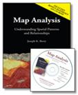
www.innovativegis.com/basis/Books/MapAnalysis/ The Map Analysis text (Berry 2007, GeoTec
Media) is Required Reading and
available at an author’s discount at the first class meeting for $34.64 (or
order from publisher for $51.95, includes U.S shipping; www.geoplace.com/books/mapanalysis). The book
includes a Companion CD-ROM containing
the MapCalc Learner and Surfer Demo software used in the
course and text files of the Recommended
Further Reading and links to the Optional
Other Reading. In addition, Keywords for Google searches and links to numerous Other Papers and Presentations that
are posted online at www.innovativegis.com/basis/ for students wanting even more information on each
Topic. |
|
W e e k |
Required |
Recommended Further Reading & Optional Other Reading |
|
|
Map Analysis Text |
Further (on companion CD-ROM) |
Other (posted on the Internet) |
|
|
1 1/5 |
Table of Contents, Foreword,
Preface
and Introduction plus online papers
on ”A
Brief History and Probable Future of Geotechnology” and “An
Analytical Framework for GIS Modeling” (1st class material online; click to view
assignments) |
About MapCalc
About Surfer About SnagIt and (1st
class material online; click to view
assignments) |
Video demos of MapCalc
usage Paper on “Incorporating
Grid-Based Map Analysis Into GIS Curricula” |
|
2 1/12 |
Topic 1 Data Structure
Implications Topic 2 Fundamental Map
Analysis Approaches |
Topic 1 Further Topic 2 Further Reading |
BM Columns on “Overview
of Basic Terminology & Structure”, “Maps
as Data & Data Structure Implications” and “Alternative
Data Structures” |
|
3 1/19 |
Topic 3 Basic Techniques in
Spatial Analysis |
Topic 3 Further Reading |
BM Columns on “Toward
an Honest GIS” Paper on “GIS
Technology in Environmental Management” |
|
4 1/26 |
Topic 4 Calculating
Effective Distance |
Topic 4 Further Reading |
Papers on “Identifying
and Evaluating Alternative Pipeline Routes & Corridors” and “Mapping
In-Store Shopper Movement” Application article
on “A
Consensus Method Finds Preferred Routing” |
|
5 2/ |
Topic 5 Calculating Visual
Exposure Topic 6 Summarizing
Neighbors |
Topic 5 Further Reading Topic 6 Further Reading |
Papers on “Incorporating
Grid-based Modeling into Linear Infrastructure Analysis” and “Characterizing
Surface Area, Length & Inclination” |
|
6 2/9 (Exam #1) |
Topic 7 Basic Spatial
Modeling Approaches |
Topic 7 Further Reading |
BM Columns on “A
Framework for GIS Modeling” and “Cartographic
& Spatial Modeling” |
|
7 2/16 (Project) |
Topic 8 Spatial Modeling
Example |
Topic 8 Further Reading |
Paper on Application articles
on “A
Mapping Firewall” and “Quantifying
Wildfire Risk” |
|
8 2/23 |
Topic 9 Basic Techniques in
Spatial Statistics |
Topic 9 Further Reading |
Paper on “Representing
Spatial Patterns & Relationships” Application articles
on “Who’s
Minding the Farm” “Precision
Agriculture” and “Precision
Conservation” |
|
9 3/1 |
Topic 10 Spatial Data Mining |
Topic 10 Further Reading |
Papers on “Site-Specific
Crop Management” and “Remote
Sensing Crop Type & Condition” Application article
on “Retail
Sales Competition Analysis” |
|
10 3/8 (Exam #2) |
Epilog |
Appendices A and B |
Papers on “Education,
Vocation & GIS Enlightenment” |
Note: right-click on the hyperlink to download lecture
presentations; PowerPoint files are posted at least 24 hours before class. Be aware that the \Links folder containing external slide sets is only available
through the class folder in the GIS Lab.
-
Week
1 – Overview [Wk1_lec.ppt -
- Week 2 – Maps as Data [Wk2_lec.ppt - Map data types and their implications; Contouring and thematic mapping effects/implications; Vector vs. raster; Raster images, grids and pseudo-grids]
- Week 3 – Reclassifying and Overlaying Map Layers [Wk3_lec.ppt - Characterizing size, shape, pattern and arrangement; Point, region and map-wide overlay; Grid math; Spatial coincidence statistics; Comparing maps; Error propagation]
- Week 4 – Measuring Distance and Connectivity [Wk4_lec.ppt - Simple vs. effective distance; Proximity and movement; Accumulation surfaces; Identifying optimal path(s); Viewsheds and visual exposure surfaces; Narrowness surfaces]
- Week 5 – Summarizing Spatial Context [Wk5_lec.ppt - Calculating slope, aspect and profile maps; Applying spatial differentiation and integration; Roving window summary operations; Characterizing edges and complexity]
- Week 6 – GIS Modeling Approaches [Wk6_lec.ppt - Deductive vs. inductive reasoning; Flowcharting spatial problems; Types of GIS models] (link to example graded_MiniProject_example.htm)
- Week 7 – GIS Modeling Examples [Wk7_lec.ppt - Pipeline routing; Wildfire risk mapping; Micro terrain analysis; Retail sales]
-
Week
8 – Surface Modeling [Wk8_lec.ppt - Basic statistics
and its
- Week 9 – Spatial Data Mining [Wk9_lec.ppt - Linking numeric and geographic patterns; Normalizing maps; Viewing scatter plots; Clustering mapped data; Investigating map correlation; Developing prediction models (spatial regression); Assessing prediction results]
-
Week
10 – Future Directions [Wk10_lec.ppt - Data exchange;
Dynamic map pedigree; Toward a humane
Note: right-click on the hyperlink to download exercise
templates; Word files are posted at least 24 hours before class.
Cross-reference MapCalc commands to ESRI Grid/Spatial Analyst
Exer0.doc – example exercise template
-
Week
1 – Overview [Exer1.doc - Dissecting a suitability
model (MapCalc)]
[Optional
MapCalc
Tutorials]
-
Week
2 – Maps as Data [Exer2.doc - Examples of spatial analysis
considerations (MapCalc)]
-
Week
3 – Reclassify and Overlay [Exer3.doc – Reclassify and
Overlay (MapCalc)]
-
Week
4 – Measuring Distance and Connectivity [Exer4.doc - Distance and
Connectivity (MapCalc)]
-
Week
5 – Summarizing Spatial Context [Exer5.doc - Neighborhood analysis
(MapCalc]
Exam #1 Study Questions — you are encouraged to study
together and exchange insights about answering the questions… if not
face-to-face, then through emails.
-
Week
6 – GIS Modeling Approaches [Exer6.doc Mini-Project
“opportunities” – designing, implementing and reporting a “directed” GIS
application model (MapCalc); extra three days to complete (due Monday,
February 20, 5:00 pm); graded Example Mini-Project from
a previous class as a benchmark]
à Click
here to take Exam #1 (return 2.5 hours after you download) … it will be posted on the class website by 8:00
am Friday February 10 and must be completed by 5:00 pm Wednesday
February 15. You will download the
exam and submit your completed exam within 2.5 hours via email to jberry@innovativegis.com. BE SURE to save your completed Word
file before you exit to submit it!!!
- Week 7 – GIS Modeling Examples [No lab assignment]
-
Week
8 – Surface Modeling [Exer8.doc – Spatial interpolation (Surfer);
or special report (4-10 pages) on a GIS Modeling topic of your own choosing]
[Optional Surfer Tutorials]
-
Week
9 – Spatial Data Mining [Exer9.doc -
Basic spatial statistics (MapCalc); or special report (4-10 pages) on a GIS
Modeling topic of your own choosing]
Exam #2 Study
Questions — you are encouraged to study
together and exchange insights about answering the questions… if not
face-to-face, then through emails.
-
Week
10 – Future Directions [No lab assignment;
in-class experience with ESRI Spatial Analysis module; Optional Exer10.doc on MapCalc
Import/Export; (click here) to
download a self-extracting zip file containing special data for Optional
Exercise #10—unzip into …\MapCalc Data
folder]
àClick here to
take Exam #2 (return 2.5 hours after you download) …posted
on the class website by 10:00
am, Friday, March 9th and must
be completed by 5:00 pm, Tuesday, March 13th. You will download the exam (time/date stamped
at our website) and submit the completed document within 2.5 hours via email to jberry@innovativegis.com. BE SURE to save your completed Word
file before you exit to submit it!!!
All of the course software is
installed on the GIS Lab computers. You
can install the software to your own computer from the Map Analysis
book’s companion CD or download from the Internet—
 Microsoft Office [you need to have working versions of Microsoft Office
applications Word, PowerPoint and Excel loaded on your computer]
Microsoft Office [you need to have working versions of Microsoft Office
applications Word, PowerPoint and Excel loaded on your computer]
![]() Adobe Reader [download and install from the Internet — Windows-based
program for viewing/printing documentation files (.pdf);
free software; see www.adobe.com/products/acrobat/readstep2.html for more
information on Adobe Reader and free download]
Adobe Reader [download and install from the Internet — Windows-based
program for viewing/printing documentation files (.pdf);
free software; see www.adobe.com/products/acrobat/readstep2.html for more
information on Adobe Reader and free download]
 SnagIt [download and install from the Internet — screen capture software; 30 day
evaluation; see www.techsmith.com/ for information on fully licensed system
($37.95 Academic
version)]
SnagIt [download and install from the Internet — screen capture software; 30 day
evaluation; see www.techsmith.com/ for information on fully licensed system
($37.95 Academic
version)]
 MapCalc Learner [install from the Map Analysis
book Companion CD — grid-based map
analysis software included with the course
materials provided by the instructor]
MapCalc Learner [install from the Map Analysis
book Companion CD — grid-based map
analysis software included with the course
materials provided by the instructor]
 Surfer Demo [install Version 8 from the Map Analysis book Companion CD — surface modeling and 3D display software included
with the course materials
provided by the instructor; also you can download Version 10 from www.goldensoftware.com/demo.shtml
but the exercises in the course will not directly correspond; see
www.goldensoftware.com and
select “Productsà
Surfer” for more information on fully licensed system ($699)]
Surfer Demo [install Version 8 from the Map Analysis book Companion CD — surface modeling and 3D display software included
with the course materials
provided by the instructor; also you can download Version 10 from www.goldensoftware.com/demo.shtml
but the exercises in the course will not directly correspond; see
www.goldensoftware.com and
select “Productsà
Surfer” for more information on fully licensed system ($699)]
___________________________