Grid-Based Techniques for Characterizing
Terrain Surface Area and Surface Line Length and Inclination
By Mario Lopez,
Computer Science,
Joseph K. Berry, Geography, University
of Denver, jkberry@du.edu
…see http://www.innovativegis.com/basis/MapAnalysis/Topic11/Topic11.htm,
select “Calculating Realistic Areas” for introductory discussion of this
topic.
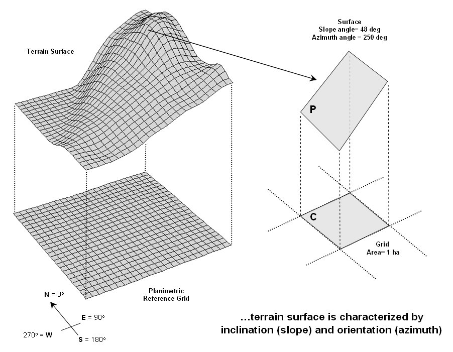
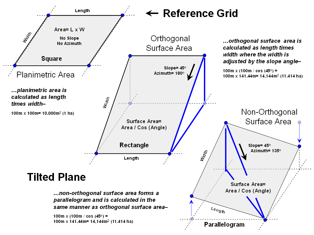
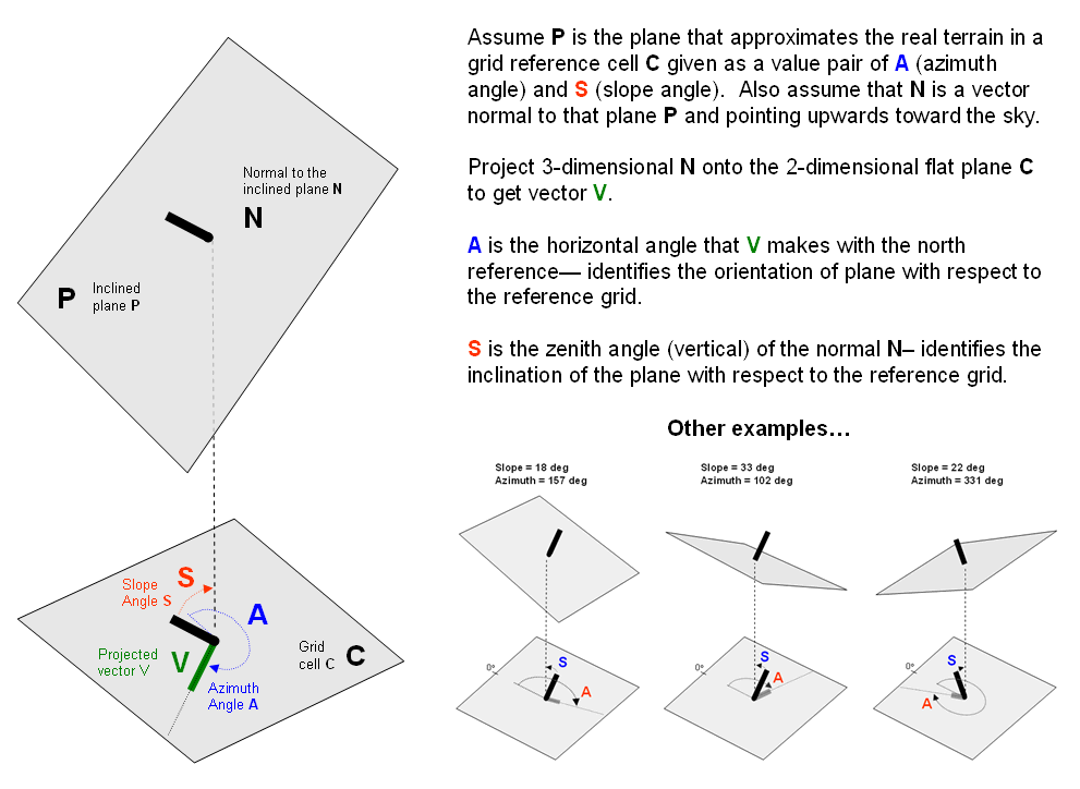
Surface Area
Background. Both vector
and grid GIS systems generally report planimetric area of map features. In grid-based reporting the area is
calculated by multiplying the number of grid cells by the planimetric area of
an individual grid cell.
However, if a corresponding
digital elevation surface is available, the slope at each grid cell can be
calculated then used to adjust planimetric area to surface area (see opposing
figure). The equation used in the translation
is—
Surface
Area = Planimetric Area / cosine(Slope Angle)
Where,
·
Surface Area
is the area of the titled plane (parallelogram) on the terrain surface
corresponding to a rectangle on the planimetric reference grid
·
Planimetric Area is the area of the rectangle on the planimetric reference grid
Slope Angle
is the inclination of the titled plane with respect to the horizontal reference
grid (see Calculating Surface Area
discussion below).
Calculating Surface Area.
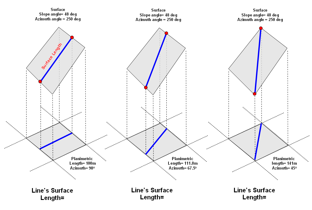
Surface Length of a Line
Slope and azimuth for each
grid cell are easily calculated. The
length of the line crossing the grid cell in planimetric space can be
determined (grid segmentation using poly/line intersection). What's needed is a procedure to adjust the
planimetric length of the line to its surface length.
If the grid cell is horizontal or the line is perpendicular to the direction of
the slope of a tilted plane, there is no correction to the planimetric length
of a line—from orthogonal (1.0 grid space to diagonal (1.414 grid space)
length. If the line’s direction is
parallel with the slope of the tilted plane (same azimuth) the full cosine
correction takes hold. These two
extremes represent the boundary conditions for adjusting planimetric length of
a line to its surface length—1) no adjustment if the surface is horizontal or
direction of the line is perpendicular to the azimuth of the tilted plane, and
2) maximum adjustment of surface length = planimetric length / cosine(slope
angle) if the line direction is parallel to the azimuth of the tilted
plane. The equation for calculating
surface length of a line is— …in preparation.
Calculating Surface Length.
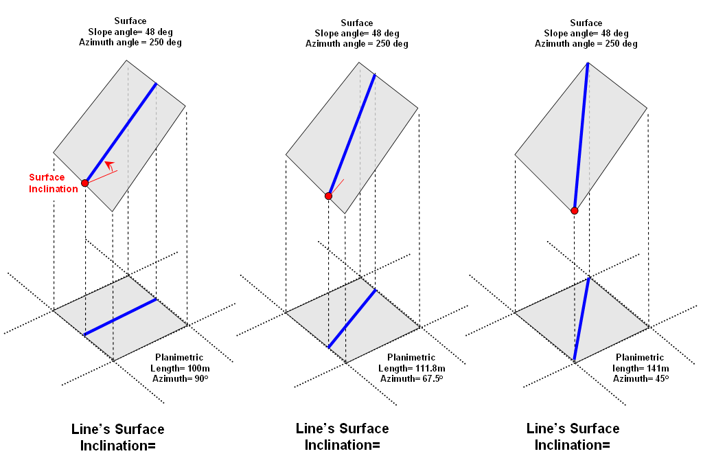
Surface Inclination of a Line
Slope and azimuth for each
grid cell are easily calculated. The
direction of the line crossing the grid cell in planimetric space can be
determined (grid segmentation using poly/line intersection). What's needed is a procedure to adjust the
planimetric representation of the line to its inclination on the 3-dimensional
surface.
If the grid cell is horizontal or the line is perpendicular to the direction of
the slope of a tilted plane, the surface inclination of the line is 0
degrees. If the line’s direction is
parallel with the slope of the tilted plane (same azimuth) the surface
inclination of the line is the same as the slope angle of the tilted
plane. These two extremes represent the
boundary conditions for determining surface inclination of a line—1) inclination
is 0 degrees if the surface is horizontal or the direction of a line is
perpendicular to the azimuth of the tilted plane, and 2) surface inclination of
a line = the slope of the plane if line direction is parallel to the azimuth of
the tilted plane. The equation for
calculating surface inclination of a line is—
… in preparation.
Calculating Surface Inclination.