Posted at www.innovativegis.com/basis/BeyondMappingSeries (Click for a printer-friendly .pdf
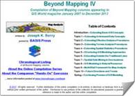
version of this document) Beyond
Mapping Compilation Series by Joseph
K. Berry
…Beyond Mapping columns appearing in GeoWorld (formally GIS World) magazine
from March 1989 through December 2013
The real estate axiom of “location, location,
location” has moved to the forefront of understanding and interacting with
our world. Prior to the digital map,
spatial information was constrained to the “precise placement of physical
features” primarily for navigation, inventory and recordkeeping. Today, the historical objective of “Where
is What” has been expanded to “Why, So What and What If” investigations of
the spatial patterns and relationships driving our physical, ecological,
economic, social and political systems.
Geotechnology (RS, GIS, GPS) has ushered in
an bold new era of mapped data visualization, interactive geo-query and
quantitative analysis of mapped data supporting spatial communication,
reasoning and dialog— “thinking with maps.” The nearly 1000 pages and more than 750 figures in
the Beyond Mapping Compilation Series provides a comprehensive and
longitudinal perspective of the underlying concepts, considerations, issues
and evolutionary development of modern geotechnology.
|
||||||||||||||||||||||||||||||||||||||||||||||||||||||||||||||||
Navigation within this tsunami of information is aided by five Organizational
Listings of the individual Beyond Mapping columns— Chronological
Listing of the nearly 300 individual Beyond Mapping
columns (.html and .pdf) Application Listing that organizes the columns by application areas (.html and .pdf) Operations Listing that organizes the columns by topic/theme discussed (.html and .pdf) Interactive Listing that can be searched/sorted by any word or phrase, topic, theme and
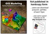
application area (Word .doc) Combined Index of keywords and phrases covering all four books (.html…in progress; planned for Fall 2014) _________________________________________ Beyond Mapping Book IV — GIS Modeling:
Applying Map Analysis Tools and Techniques is an online/electronic
book organizing the columns from 2007 to 2014 into 10 Topics,
Introduction, Epilog and online support material including Additional
Readings, Color Graphics files, Instructor Materials and software for
hands-on exercises cross-referenced to the topics.
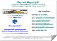
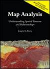
Beyond Mapping Book III — Map
Analysis: Understanding
Spatial Patterns and Relationships is an online/hardcopy book organizing the
columns from 1996 to 2007 into 10 Topics, Introduction, Epilog and
CD-ROM containing Additional Readings, Color Graphics files, Instructor
Materials and software for hands-on exercises cross-referenced to the topics.
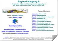
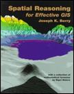
Beyond Mapping Book II — Spatial
Reasoning for Effective GIS is an online/hardcopy book
organizing the columns from 1993 to 1996 into 10 Topics, Introduction
and Epilog.
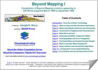
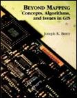
Beyond Mapping Book I — Beyond Mapping:
Concepts, Algorithms and Issues in GIS is an online/hardcopy book organizing the columns from 1989 to
1993 into 10 Topics, Introduction and Epilog.
|
||||||||||||||||||||||||||||||||||||||||||||||||||||||||||||||||


Permission to use portions of the Beyond
Mapping Compilation Series collection of columns for educational
and non-commercial
purposes is granted provided reference is made to the author and the URL
of the Beyond Mapping
Compilation Series Topic of the online book containing the materials—
For example… Figure is from Berry, Beyond Mapping
Compilation Series, Book I, Topic 4 “What GIS Is and Isn’t”
posted
at: www.innovativegis.com/Basis/BeyondMappingSeries/