Optimal Routing and Corridor Analysis for
Electric Transmission Line Siting, EPRI Environmental Sector Meetings, Water &
Ecosystem Area Council
View/download materials from http://www.innovativegis.com/basis/EPRI_GTC/
...
Click below for links to slideshows and other materials supporting the presentation. Choose “Open” to run the slideshow from temporary memory or “Save Target As…” to download and store on your computer (Internet Explorer).
 Presentation
PowerPoint.
The presentation describes the routing methodology and results of the
EPRI_GTC project. <click
here to view or download> (8.75 MB)
Presentation
PowerPoint.
The presentation describes the routing methodology and results of the
EPRI_GTC project. <click
here to view or download> (8.75 MB)
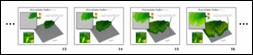 Animated
Accumulation Surface Derivation. A series of slides showing the development of an
Accumulation Surface used in identifying an optimal path. <click here to view or download> (1.7
MB)
Animated
Accumulation Surface Derivation. A series of slides showing the development of an
Accumulation Surface used in identifying an optimal path. <click here to view or download> (1.7
MB)
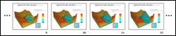 Animated
Total Surface Flooding. A series of slides showing the development and
flooding of a Total Surface used in identifying an optimal corridor. <click here to view or
download > (2.1 MB)
Animated
Total Surface Flooding. A series of slides showing the development and
flooding of a Total Surface used in identifying an optimal corridor. <click here to view or
download > (2.1 MB)
¾
Download
All Three Files At Once. Download the presentation PowerPoint and its two
linked animated slide sets as Zip
file. From Windows Explorer,
double-click on the saved file and extract the files to an appropriate
folder. <click here> (11.2 MB)
¾ Links to related materials…
GeoWorld
magazine feature article on the EPRI_GTC project…
http://www.geoplace.com/gw/2004/0404/0404pwr.asp
GeoTec
Conference paper on general approach to identifying optimal paths and
corridors…
http://www.innovativegis.com/basis/present/GeoTec04/GIS04_Routing.htm
Online
book chapter on Routing and Optimal Paths…
http://www.innovativegis.com/basis/MapAnalysis/,
select Topic 19
White
Paper on
http://www.innovativegis.com/basis/Supplements/BM_Sep_03/T39_3_DELPHIsupplement.htm
White
Paper on
http://www.innovativegis.com/basis/Supplements/BM_Sep_03/T39_3_AHPsupplement.htm