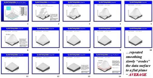
Spatial Expression of Arithmetic Average
“Mapping the Variance”
…
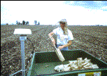
Soil Samples
are collected with GPS coordinates
…the location and nutrient levels of the sample points
(
Discrete Data
) are used to estimate the nutrient
pattern throughout the field (
Continuous Data
)
(
Berry
)