 |
|
|
|
|
|
|
|
|
|
|
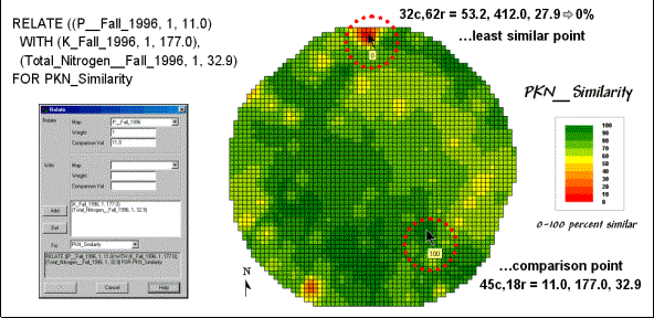
Identifying Map Similarity
|
|
|
|
|
|
|
…the relative data distance between the comparison point’s
data pattern
|
|
|
and
those of all other map locations form a Similarity Index
|
|
|
|
|
|
 |
|
|
|
The green
tones indicate field locations with fairly similar P, K and N levels; red
tones indicate dissimilar areas.
|
|
|
|
|
|
|
|