Micro Terrain Analysis
(a simple erosion model)
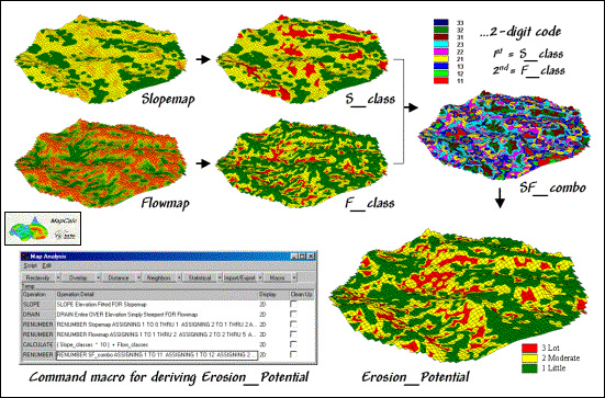
Determining Erosion Potential:
The slope and flow classes are
combined into a single map identifying erosion potential
(
Berry
)