Applying MapCalc Map Analysis Software
Transferring Data to MapInfo Tables: A market analyst needs to transfer
information on travel-time from a client’s store that was derived in MapCalc to
a MapInfo table identifying the residences of customers. This information will be invaluable in
geo-query and statistical summary of customer characteristics within specified
zones of proximity.
<click here> for a
printer friendly version (.pdf)
Base Data. See
the Travel-Time and Customer Access application for procedures used to
append travel-time data derived in MapCalc to a “pseudo grid” stored in
MapInfo.
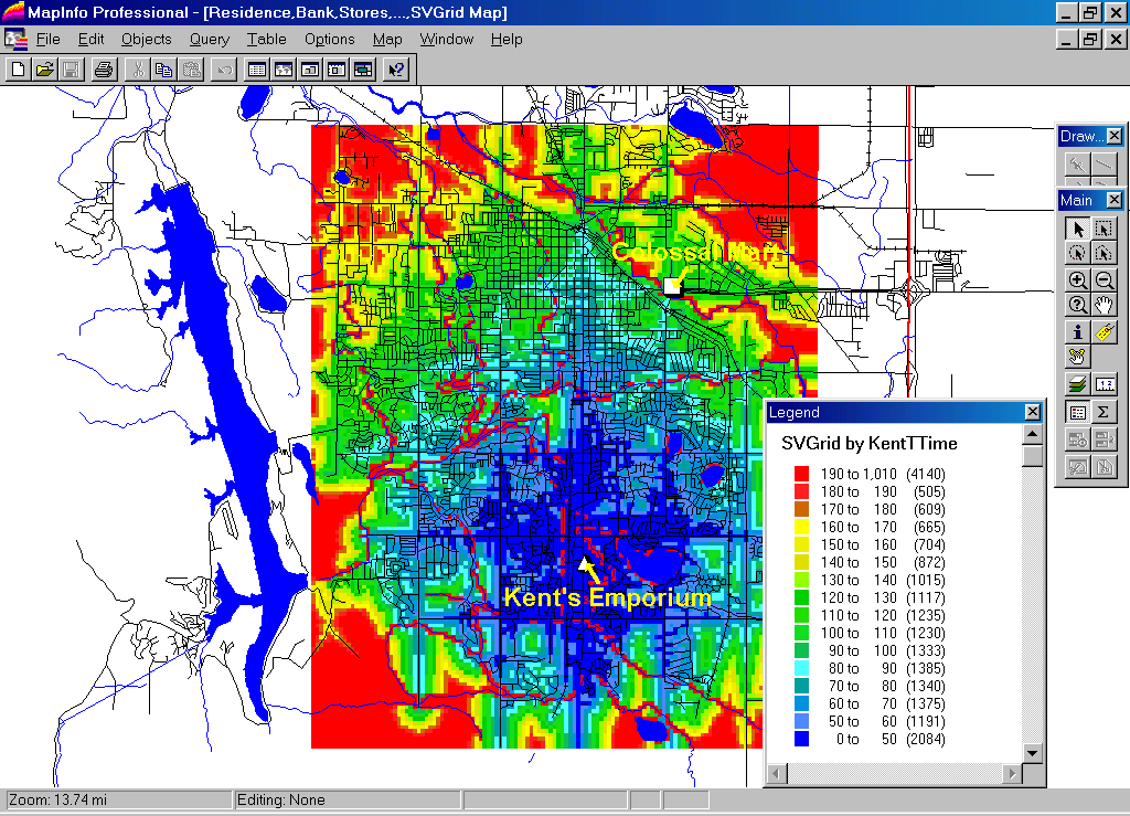
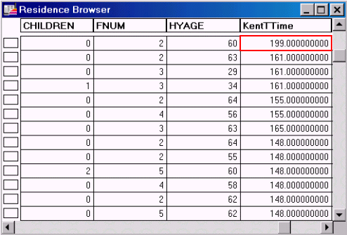
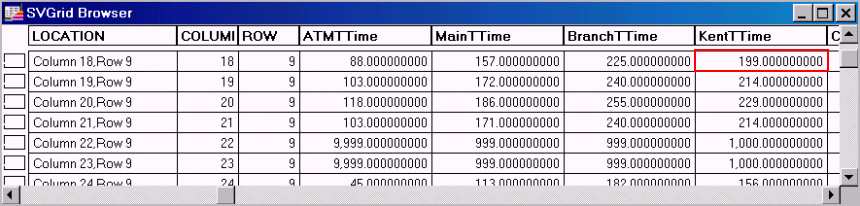 SVGrid
Browser. The MapInfo table for the “pseudo grid” identifies the travel-time for
each cell in the grid. For example, the
farthest away location on a street is nearly 20 minutes (199 units * 6 sec per
unit= 1194 sec / 60 sec per min= 19.9 min)… top row in the table under the
column “KentTTime.”
Potential customers at this location need strong motivation to visit the
store.
SVGrid
Browser. The MapInfo table for the “pseudo grid” identifies the travel-time for
each cell in the grid. For example, the
farthest away location on a street is nearly 20 minutes (199 units * 6 sec per
unit= 1194 sec / 60 sec per min= 19.9 min)… top row in the table under the
column “KentTTime.”
Potential customers at this location need strong motivation to visit the
store.
 Residence Map. The residences of customers and related
information are stored as “point features.”
Residence Map. The residences of customers and related
information are stored as “point features.”
Step 1. The
information on travel-time derived in MapCalc and transferred to the pseudo grid
in MapInfo can be easily appended to other maps.
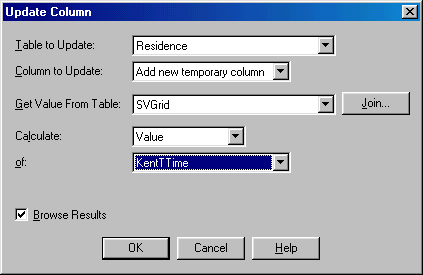 Update Column Dialog Box. From MapInfo’s main menu, select Tableà
Update Column to access the update form.
The Residence map is specified as the table to update and the SVGrid map (pseudo grid) is specified as the table
providing the values. The values for KentTTime in the SVGrid table
will form a new column in the Residence table.
Update Column Dialog Box. From MapInfo’s main menu, select Tableà
Update Column to access the update form.
The Residence map is specified as the table to update and the SVGrid map (pseudo grid) is specified as the table
providing the values. The values for KentTTime in the SVGrid table
will form a new column in the Residence table.
Step 2. Pressing
the “Join…" button in the Update
Column dialog box pops-up a form for specifying the spatial conditions used to
link the two tables.
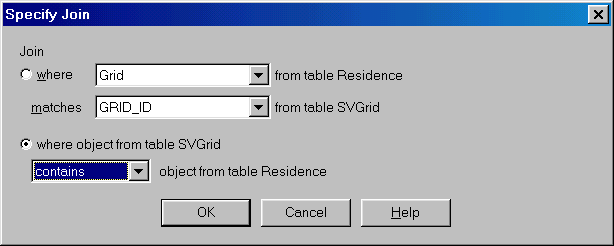 Join Dialog Box. The “contains” option is specified for the
spatial join. This directs the computer
to identify which pseudo grid cell (square polygon) a point falls within then
extracts the travel-time value for that cell and records it in the new column
of the Residence table.
Join Dialog Box. The “contains” option is specified for the
spatial join. This directs the computer
to identify which pseudo grid cell (square polygon) a point falls within then
extracts the travel-time value for that cell and records it in the new column
of the Residence table.
 Updated Residence
Table. The “KentTTime” values form a new column in the Residence
table. This information can be used in
the same manner as any of the other demographic information directly encoded
into the table.
Updated Residence
Table. The “KentTTime” values form a new column in the Residence
table. This information can be used in
the same manner as any of the other demographic information directly encoded
into the table.
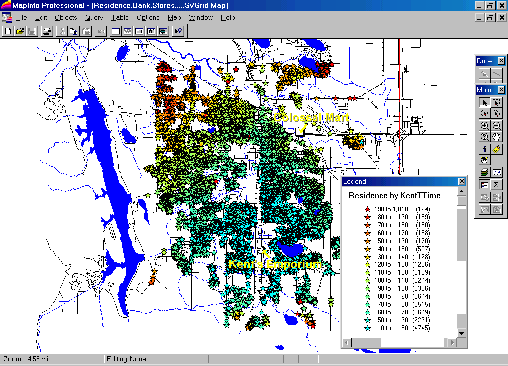
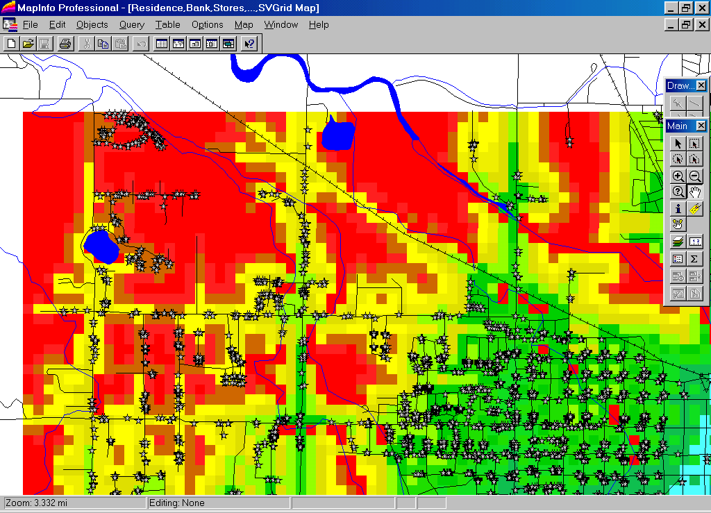
Residence
Themed by KentTTime. The spatially derived attribute
identifying the travel-time from each residence to the store can be themed and
displayed for visual analysis of the pattern.
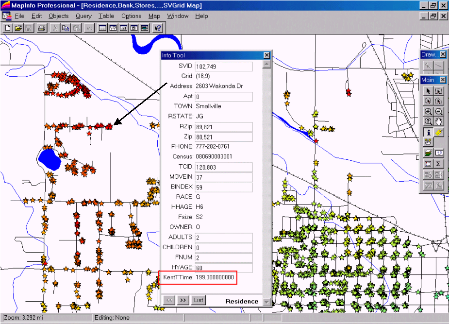
Information for
a Residence. The
travel-time information “joined” to the Residence map and can be interactively
queried using the Info Tool. SQL
queries, such as customers above a certain income level, can be summarized by
their effective distance from the store—are pockets of targeted customers near
or far from the store?
Summary.
Travel-time analysis is an important part of
Note: A similar exchange of information between
MapCalc and ArcView, ArcInfo or ArcGIS can be
made. A detailed listing of the steps
used in the “Point-in-Polygon”
data transfer within MapInfo is attached.