Applying MapCalc Map Analysis Software
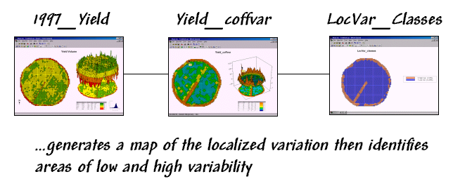
Assessing Localized Variation in Yield: An agricultural scientist wants to locate
areas in a field that exhibit highly variable yield patterns. In data analysis and the development of yield
models, these areas should be treated differently from areas that have
consistent yield levels.
<click
here> for a printer friendly
version (.pdf)
Processing Flow.
Base Maps. The Base Maps needed include:
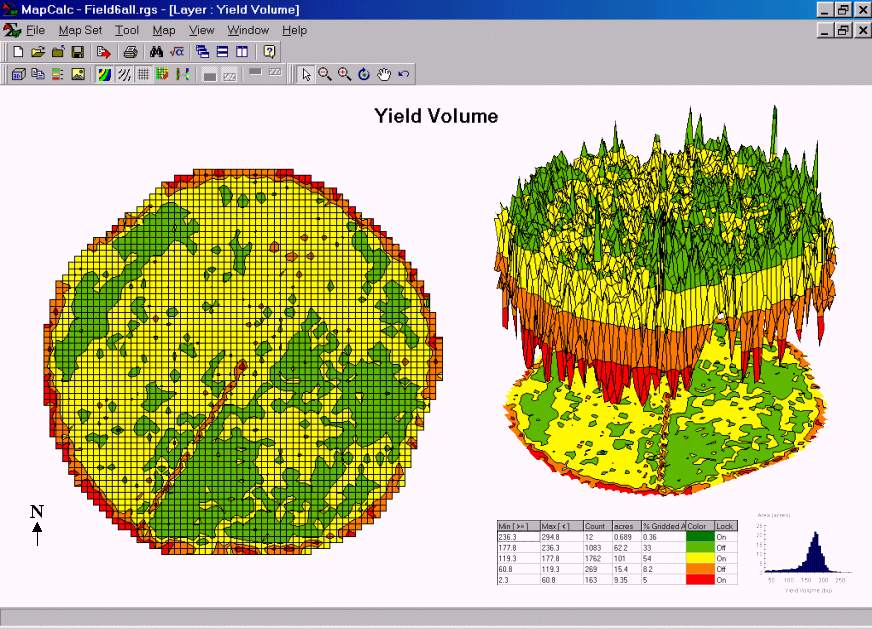 Yield Map. The corn yield in the field varies from a low
of 2.3 (red tones) to a high of 295 bushels (green tones).
A yield map plots the spatial pattern of the data. The 2-D contour map on the left shows the
yield data classified into seven equal interval classes. The 3-D map on the right plots the actual
variation within the data.
Yield Map. The corn yield in the field varies from a low
of 2.3 (red tones) to a high of 295 bushels (green tones).
A yield map plots the spatial pattern of the data. The 2-D contour map on the left shows the
yield data classified into seven equal interval classes. The 3-D map on the right plots the actual
variation within the data.
Step 1. The MapCalc operation…
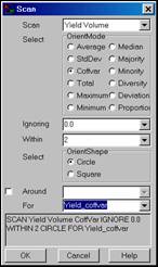 Slope Yield_Volume within 2 for
Yield_coffvar.
Slope Yield_Volume within 2 for
Yield_coffvar.
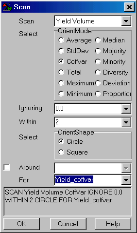
…creates a map of localized yield variability by calculating the coefficient of variation within a two-cell radius of each map location (Coffvar= ((stdev/mean) * 100) .
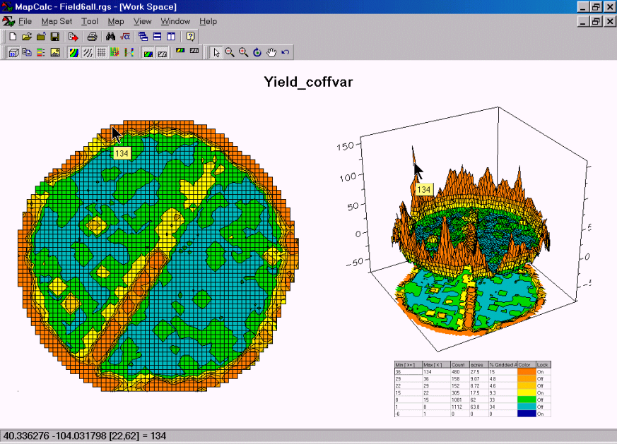 Yield_coffvar Map. The blue tones
in this map indicate areas with low localized variability. The tan
tones and large spikes in the 3-D display identify areas with high variability—
field edges and the access road for the central pivot equipment.
Yield_coffvar Map. The blue tones
in this map indicate areas with low localized variability. The tan
tones and large spikes in the 3-D display identify areas with high variability—
field edges and the access road for the central pivot equipment.
Step 1. The MapCalc operation…
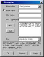 Renumber Yield_coffvar assigning 1 to 0 thru
33 assigning 2 to 33 thru 200.
Renumber Yield_coffvar assigning 1 to 0 thru
33 assigning 2 to 33 thru 200.
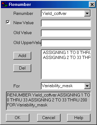
…creates a map that partitions the field into two data groups— areas with minimal localized variation (1) and areas with high variability (2) in crop yield.
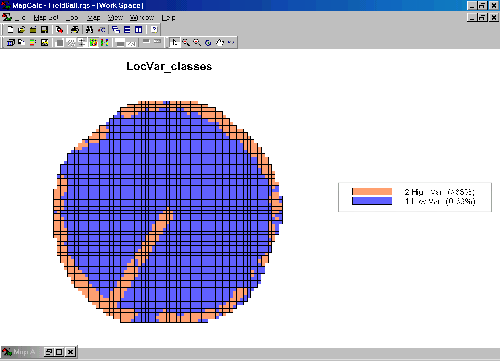
LocVar_classes Map. This map groups the yield data for the field into two classes of localized variability. Knowing that the high variability appears to coincide with edges (field boundary and access road), a proximity tool could be used to buffer these areas and create a “mask” to eliminate the yield data for these “unusual” areas in developing a generalized yield model for the field.
Summary. The spatial patterns in yield data can help scientists understand the complex interactions in biological systems. The ability to partition a set of field-collected data by spatial characteristics, such as localized variability, enhances data analysis and aids in the development of spatially segmented models.