Applying MapCalc Map Analysis Software
Determining Proximity: A wildfire response team needs to
determine the relative proximity of all off-road areas to existing roads for
estimating response time should a fire occur.
This information will be used in fire response planning.
<click
here> for a printer friendly
version (.pdf)
Processing Flow.
Base Maps. The Base Maps needed include:
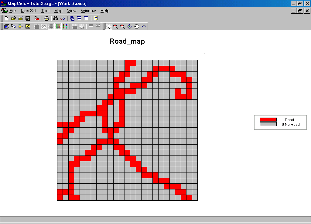 Road Map. Each grid cell serves as a “starter location”
for measuring distance to all other locations.
Road Map. Each grid cell serves as a “starter location”
for measuring distance to all other locations.
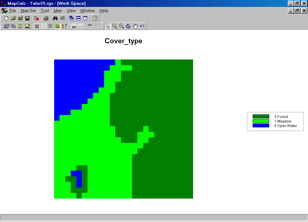 Cover_type Map. Each grid cell identifies the type of land
cover present at that location. Areas of
open water cannot be crossed while meadows and forest can be crossed but at
different levels of difficulty.
Cover_type Map. Each grid cell identifies the type of land
cover present at that location. Areas of
open water cannot be crossed while meadows and forest can be crossed but at
different levels of difficulty.
Step 1. The MapCalc operation…
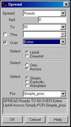 Spread roads to 100 for Simple_prox
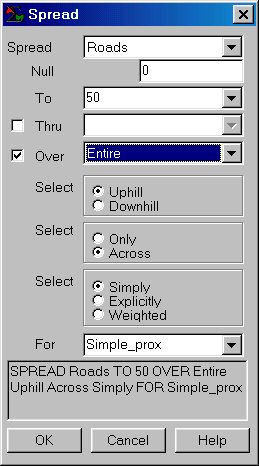
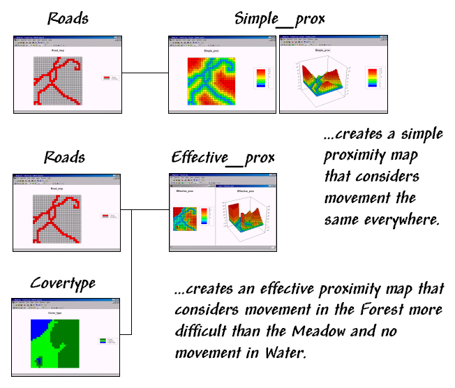
…creates an “as-the-crow-flies” proximity map identifying the shortest, straight line distance from each grid cell to the nearest road location.
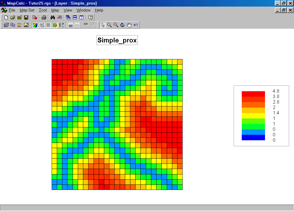
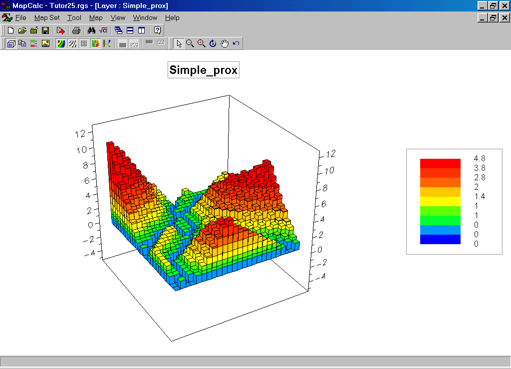
Simple_prox Map. The cooler tones (blue) identify areas close to roads while the warmer tones (red) indicate areas far from the nearest road. While the color zones look like a progressive series of buffers (color interval), each grid cell contains the actual distance value. The 3-D display shows the shape of the accumulation surface with the “peaks” locating cells that are far away from roads. Note that the surface is always rising and if the starting point were a point the surface would form a bowl.
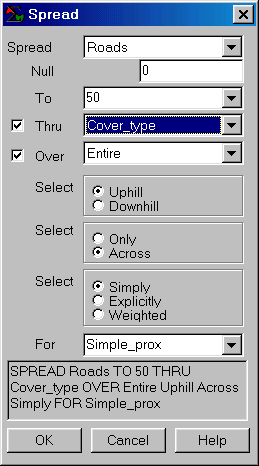
Step 2. The MapCalc operation…
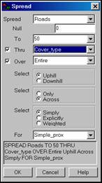 Spread roads to 100 thru cover_type for Effective_prox1
…creates a proximity map that respects the relative ease of movement under different cover types. Open Water (0) cannot be traversed; Meadows (1) represent the easiest off-road travel; while Forests (5) represent “five times” the difficulty of travel. In this instance the numbers correspond to relative ease of crossing and an effective proximity map is generated. If each cell were assigned a value representing the time in minutes to cross, the result would be a travel-time map.
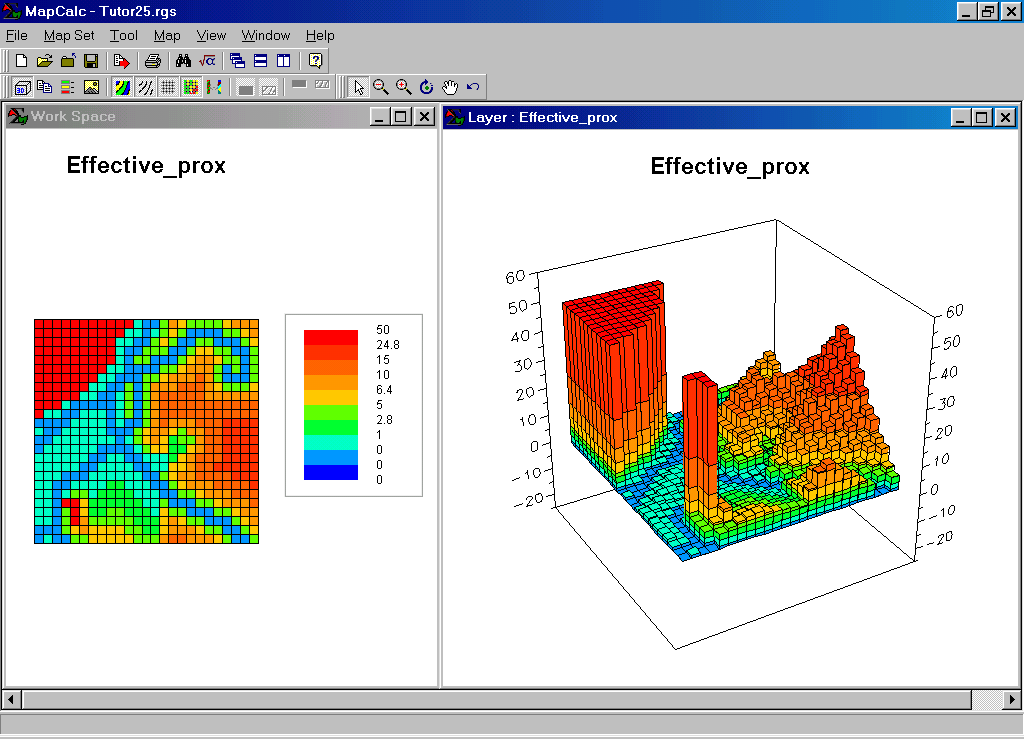
Effective_prox Map. The introduction of absolute and relative barriers to movement radically changes the proximity surface. The two tall spikes (bight red) correspond to open water that are infinitely far away from roads as the fire equipment would sink. While the other peaks in the Simple_prox surface were about equally far away from roads “as-the-crow-flies,” they show very different access for the Effective_prox surface considering the difference in traveling in meadow areas (relatively fast) and forest areas (relatively slow). The areas along the bottom of the map are effectively much closer (mostly meadow) than those along the right side (mostly forest).
Summary. To be effective, wildfire response planning must consider real world effects on off-road travel. A simple “buffer” drawn a specified straight-line distance fails to consider the relative ease of movement under a variety of land cover conditions. Other factors, such as on-road movement considering different types of roads and off-road movement under different terrain slopes, can be included for even more realistic assessment of wildfire response.
Note:
See the Travel-Time and Customer Access application for use of effective
proximity in determining relative access to a store respecting the inability to
traverse open water (absolute barrier), the relative ease of travel along
primary and secondary roads, and the much slower travel by walking where there
are no roads (relative barriers).