Applying MapCalc Map Analysis Software
Delineating and Summarizing Core Area: A wildlife biologist needs a map that
identifies core area for meadow parcels in a research area and the distance to
water for each location in the core area.
This information will be analyzed with nesting information about various
ground-nesting birds.
<click
here> for a printer friendly
version (.pdf)
Processing Flow.
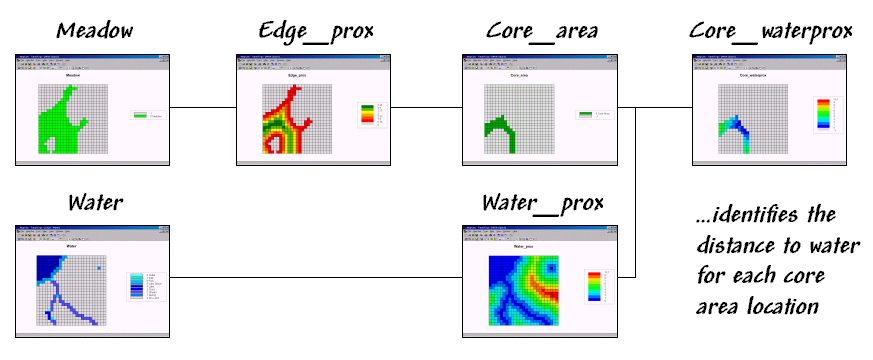
Base Maps. The Base Maps needed include:
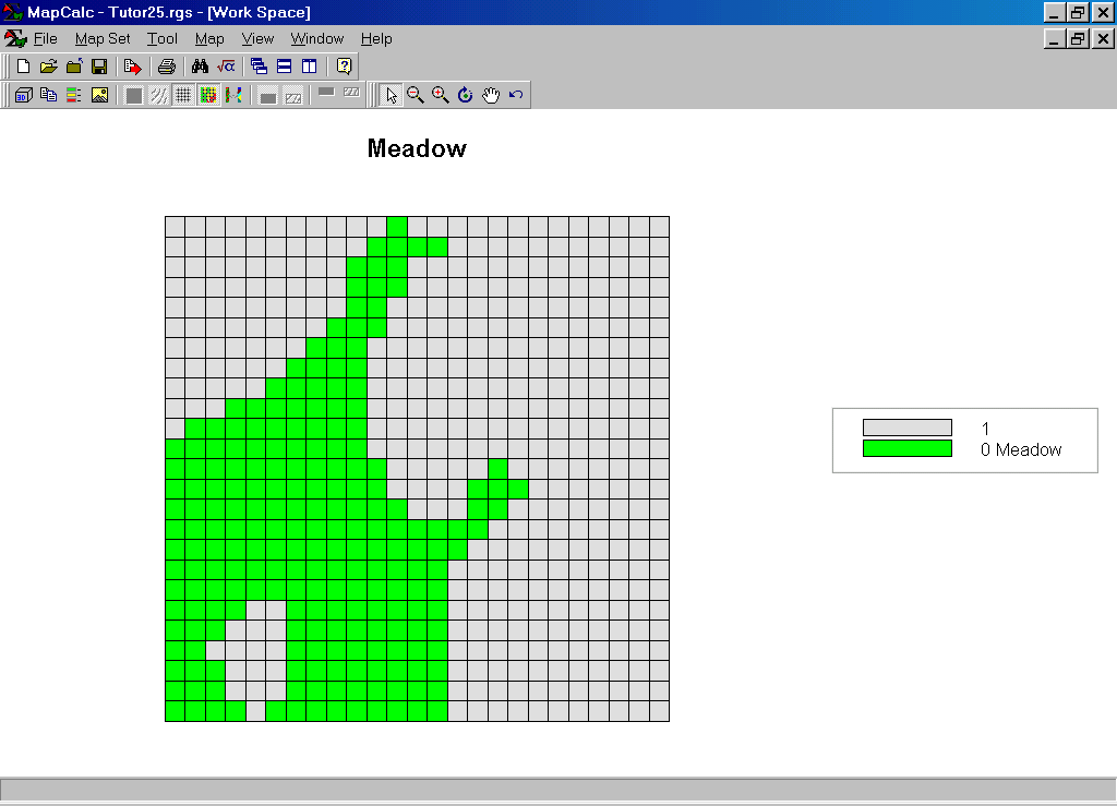 Meadow Map. This map was created by Renumbering
the Covertype map to isolate the meadow area.
Notice that the value 0 was assigned to the meadow area while 1 was
assigned to the non-meadow areas. This
value assignment will be useful in a subsequent processing step (Spread).
Meadow Map. This map was created by Renumbering
the Covertype map to isolate the meadow area.
Notice that the value 0 was assigned to the meadow area while 1 was
assigned to the non-meadow areas. This
value assignment will be useful in a subsequent processing step (Spread).
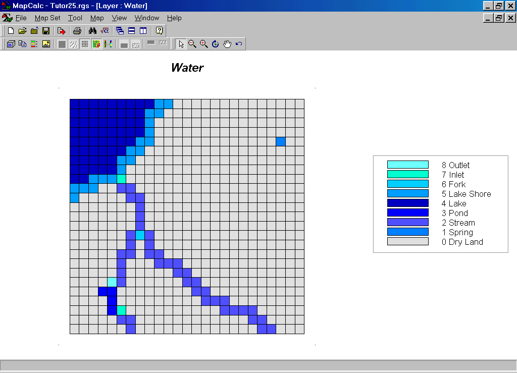 Water Map.
Potable water is available within any of the locations shown in blue tones.
Water Map.
Potable water is available within any of the locations shown in blue tones.
Step 1. The MapCalc operation…
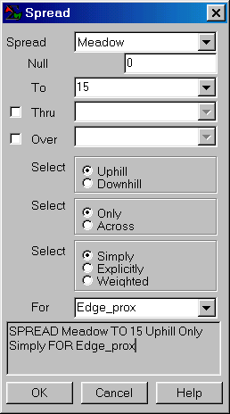 SPREAD Meadow TO 15 FOR
Edge_prox
SPREAD Meadow TO 15 FOR
Edge_prox
…creates a map of the proximity to the edge for all of the meadow cells. The Spread operation calculates proximity for any area containing 0 on the Spread <mapName> map— the meadow area in this case.
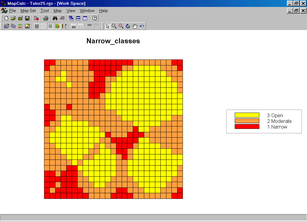
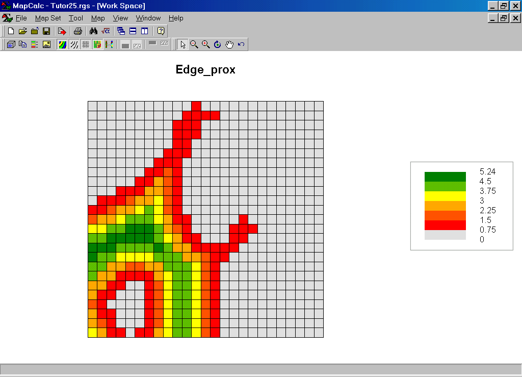 Edge_prox Map. The red tones
indicate locations near the edge of the meadow; green
tones indicate locations farther away.
Edge_prox Map. The red tones
indicate locations near the edge of the meadow; green
tones indicate locations farther away.
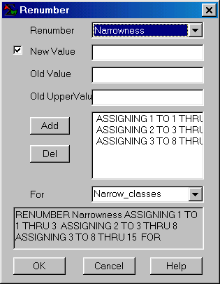
Step 2. The MapCalc operation…
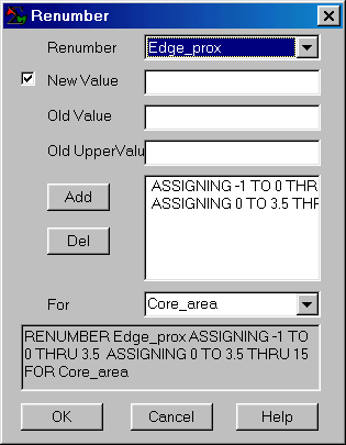 RENUMBER Edge_prox ASSIGNING -1 TO 0
THRU 3.5 ASSIGNING 0 TO 3.5 THRU 15 FOR Core_area
RENUMBER Edge_prox ASSIGNING -1 TO 0
THRU 3.5 ASSIGNING 0 TO 3.5 THRU 15 FOR Core_area
…creates a map that isolates the core area as locations more than 3.5 cells away from the meadow’s edge (3.5 cells * 100m/cell = 350 meters away).
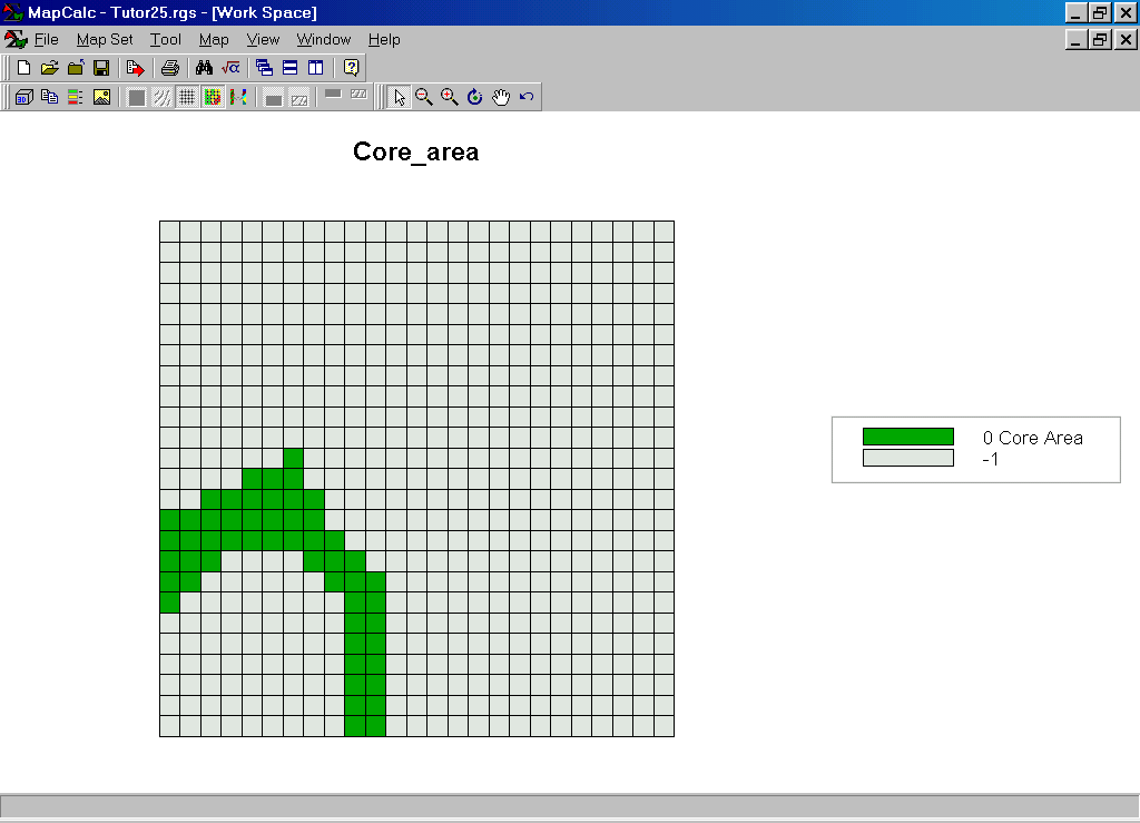 Core_area Map. Notice that the value 0 was assigned to the
core area while –1 was assigned to the non-core areas. This value assignment will be useful in a
subsequent processing step (Cover).
Core_area Map. Notice that the value 0 was assigned to the
core area while –1 was assigned to the non-core areas. This value assignment will be useful in a
subsequent processing step (Cover).
Step 3. The MapCalc operation…
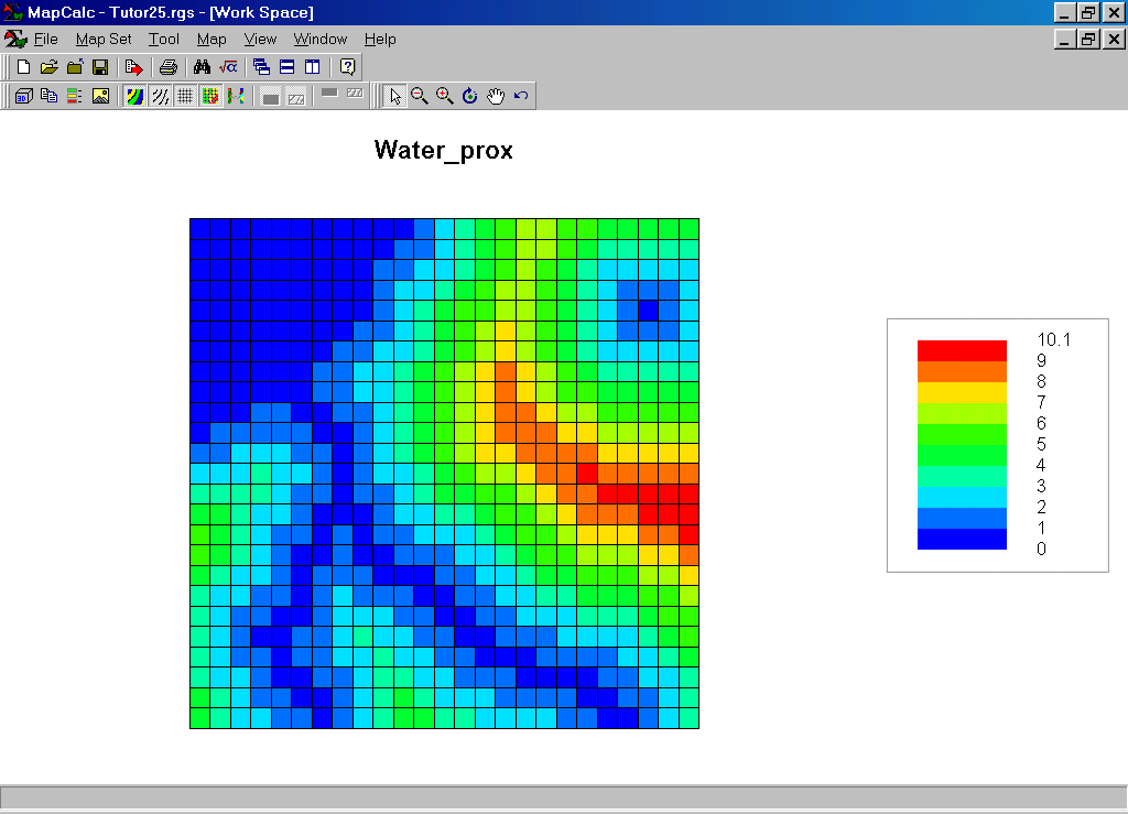
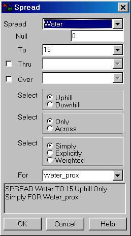 SPREAD Water TO 15 FOR Water_prox.
…creates a map that identifies the distance from all locations to the nearest source of flowing water.
Step 4. The MapCalc operation…
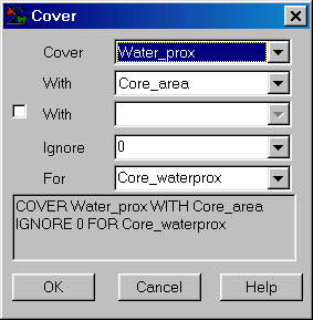 COVER Water_prox WITH Core_area IGNORE 0
FOR Core_waterprox.
COVER Water_prox WITH Core_area IGNORE 0
FOR Core_waterprox.
…creates a map of the proximity to water for just the core area.
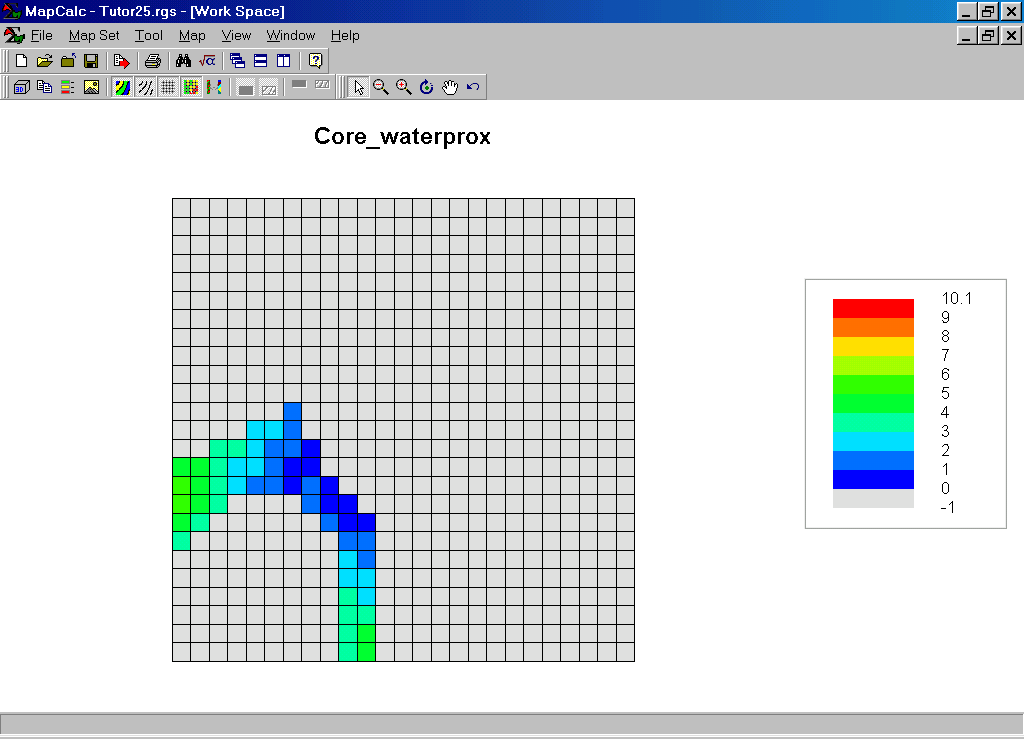 Core_waterprox Map.
Summary. The Spread operation is used to calculate proximity. In this case proximity to meadow edge was calculated then that map was used to identify Core Areas (distant from edge). Spread was used again to identify proximity to water then this information was isolated for just the Core Area. The information will be used in research of ground-nesting birds’ preferences.