Forest Availability and Accessibility Model — Companion materials
PowerPoint slide set—
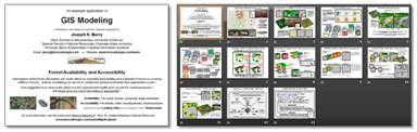 <click
here> for a PowerPoint slide set (3.8MB) of the 3-part Beyond Mapping series (GeoWorld,
April-June, 2010) on “Assessing and Characterizing Relative Forest Access” (Topic
29, sections 1-3).
<click
here> for a PowerPoint slide set (3.8MB) of the 3-part Beyond Mapping series (GeoWorld,
April-June, 2010) on “Assessing and Characterizing Relative Forest Access” (Topic
29, sections 1-3).
Hands-on exercise
materials—
<click here> to
download an self-guided Exercise
write-up demonstrating the concepts and procedures of a grid-based GIS
model for “Assessing and Characterizing
Relative Forest Access.”
<click
here> to download the special ForestAccess.rgs database used in the exercise. This is a self-extracting ZIP file
that needs to be “unzipped” into the same folder as the other MapCalc Data sets
(default is C:\Program
Files\Red Hen Systems\MapCalc\MapCalc Data\).
<click
here> to download the special command scripts used in
the exercise (ForestAccess_basic.scr, ForestAccess_extended.scr and ForestAccess_landings.scr). This is a self-extracting ZIP file
that needs to be “unzipped” into the same folder as the other MapCalc Scripts
(default is C:\Program
Files\Red Hen Systems\MapCalc\MapCalc Data\Scripts\).
…Note:
to unzip a file, 1) click on <click
here>, 2) respond “Run” to
execute the self-extracting file, 3) “Run”
to Publisher Verification warning, 4) Browse
to the appropriate folder noted above and 5) press “Unzip” button.
__________________________________________
The exercise uses the MapCalc Learner software. If
you do not have it installed on your computer—
MapCalcLearner — click on this link and select Open/Run to download MapCalc Learner
and basic datasets. Follow the
onscreen installation instructions. It is
recommended that you accept the default specifications as exercise write-ups
assume this installation location (C:\Program
Files\Red Hen Systems\MapCalc\). Use Serial Number 1374MS2-0F5050-V and Release Code 6EE3-59C8-EA4B-EFB7 to register the educational MapCalc Learner version beyond the 14-day
trial period.
To access MapCalc, select Startà Programsà MapCalcà MapCalc Learner. In the Quick Start box select “Open existing
map set” and browse to the …\MapCalc Data folder (default C:\Program
Files\Red Hen Systems\MapCalc\MapCalc Data\) on your computer and select the
appropriate “.rgs” database as instructed in the exercises.
 MapCalc Learner is a grid-based map analysis software package
specifically designed to help students learn the rich range of analysis options
available in the raster domain. The
educational version is constrained to a 100 column by 100 row configuration and
a Latitude/Longitude WGS84 coordinate system.
Additional materials (optional) you might find of interest include—
MapCalc Learner is a grid-based map analysis software package
specifically designed to help students learn the rich range of analysis options
available in the raster domain. The
educational version is constrained to a 100 column by 100 row configuration and
a Latitude/Longitude WGS84 coordinate system.
Additional materials (optional) you might find of interest include—
MapCalcTutorials — click on this link to download the basic MapCalc Tutorials. You must have Adobe Reader installed to view.
MapCalc
User’s Manual — click on this link to download
the MapCalc User’s Manual. You
must have Adobe Reader installed to view.
MapCalc
Data Sets — click on this link to download
an extended set of MapCalc datasets.
This is a self-extracting Zip file; extract to a different folder than
the basic MapCalc Data (e.g., …\extended MapCalc Data).
MapCalc
Description & Examples — click on this link to access several GIS
modeling examples using MapCalc for hands-on experience with map analysis
capabilities.
An
Analytical Framework for GIS Modeling — click
on this link to access a white paper
presenting a conceptual framework for Map Analysis and GIS Modeling by J.K. Berry and Shitij Mehta (BASIS, 2009).
BASIS Website — click on this link to access the online book Beyond
Mapping III and numerous materials supporting map analysis learning and
instruction that are available for free download.
Map
Analysis — click
on this link to access a description of the Map Analysis book and companion CD that provides a structured view
of grid-based map analysis and modeling with software for “hands-on” exercises by J. K. Berry (GeoTec Media, 2007; US$45).

![]()