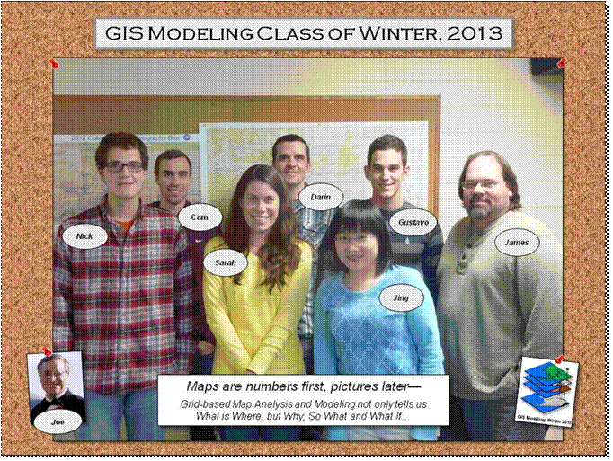
GIS
Modeling Class, GEOG 3110, Winter Term 2013
Nicolas
I'm an
undergraduate student in my senior year majoring in geography and philosophy. I
have taken a handful of GIS related courses after the introductory course
including GIS analysis and some work in remote sensing. Most of my work has
been in ESRI ArcMaps, though I used IDIRISI in remote
sensing, so I have some experience adapting to other software packages. I don’t
have specific research interests, but am generally interested in learning about
the capabilities of GIS and its related fields. My primary objectives for the
course are to expand my skill set and improve my post graduation employability.
Cameron
My name is Cameron Bentley, but
most people just call me Cam. I actually just transferred to DU, so this past
fall quarter was my first at DU. I transferred from Elon
University in North Carolina where I was an exercise sports science major up
until my last semester there. Now I am an environmental science major but would
like to try to minor in GIS as well.
I just completed an interterm course in December with Steve Hicks and Heather
Hick in Hawaii, and we touched upon GIS during the course. The Hawaii interterm
course was a natural disaster/hazards course and I was intrigued how GIS can be
applied and utilized in these situations. I know GIS can be used in many
situations but I would say I am more interested in how it can be used to help
people, similar to how it would be used in Colorado.
This course will be my first full GIS course. I am excited by the
challenge of this course, but am also slightly concerned it might present its
fair share of difficulties for me as I have actually taken any GIS courses to
date. Although, with a small class size it might be easier to
follow and digest the material.
Gustavo
I
have a BS in Environmental Engineering from the Federal University of Vicosa in Brazil, and I am currently a second year MS
student in the Geographic Information Science program. I have been working with
geospatial technologies for about 7 years, through internships and
volunteering positions. I am currently working as a Solution Engineer Intern at
Esri, and a Remote Sensing Analyst Intern with the USGS.
I have used raster data mostly when working with imagery and not so much in a
GIS workflow. For my thesis, I am working with Dr. Michael Daniels and we
are going to build an erosion susceptibility model for a site in the
Czech Republic. Thus, I am hoping to learn more about using raster
data for environmental modeling purposes, and more importantly, being able to
think spatially using an statistical or "Map-ematical"
approach when working with this type of data. I am sure that I will be
able to learn a lot from your experience in the field, and I
look forward to our first class next week.
James
I am a second year MSGISc student.
I will be completing my degree this June. I have experience with ArcGIS and
remote sensing. Primarily, I have dealt with vector data with the exception of
remotely sensed imagery. Last year, I completed an internship with Jefferson
County GIS Services. That position involved utilizing ArcMap
as a strictly cartographic tool as opposed to an analytical one. At the
conclusion of the JeffCo internship, I began working
for the USGS, where I am currently employed. I work in the National Geospatial
Technical Operations Center (NGTOC) systems development branch. My main duties
involve working with vector products for The National Map viewer and download
framework. I look forward to the course
and working with raster data and conducting more analysis than my previous
experience. Best, James
Sarah
I'm a second-year PhD
student in Geography working with Matthew Taylor. I'm a human geographer, and
have not narrowed my dissertation topic as closely as I need to yet --
possibilities include waste-to-energy in Jamaica, hydroponic lettuce in
Honduras, or renewable energy and electrification in Nicaragua. All of these
topics have inherently spatial themes (but I have some serious focusing to do, asap!).
I want to take this class because
my GIS skills are rudimentary at best, and I'd like to have this as a solid
tool as a geographer. I've taken an intro to GIS course during my master's
degree, which was in 2005, and I really haven't used GIS since. I did take a
three day ESRI GIS basics class in 2009 when I lived in Washington DC; but I've
never really used GIS in an applied sense. I am a geographer because I love the
spatial aspects of the discipline. I've now taken two graduate level statistics
classes for geography, though this is certainly not my strong suit. I'd
appreciate your opinion if you think this course will be appropriate for me --
I don't want to be in way over my head (though I do expect a bit of a learning
curve).
Darin
Background: Masters in
Landscape Architecture, Current PhD student in Biology department (ecology
focus); no previous experience with GIS; introductory statistics; introductory
modeling practice; familiarity with AutoCAD.
Interests: Spatial statistics,
predictive models, remote sensing, plant community dynamics and human
disturbances.
Objectives: Gain working
knowledge of GIS and spatial statistical modeling, implement course materials
in PhD project and become aware of the range of datasets that are available for
spatial modeling of ecosystem dynamics.
Jing
I am
the newest faculty member in the Geography Department receiving my doctorate in
geography from George Mason University
last year.
My interests are in 3D/4D Geo-visualization and
Visual Analytics, Spatial Temporal Modeling and Analysis, Web-based Geographic
Information Science (GISc), High Performance
Geo-computation and Spatial Cloud Computing.
I believe auditing the course will be
extremely helpful to me.
______________________________